

Newsroom
-
 Africa's Great Green Wall Holds Great Potential for Land Degradation Neutrality, Study Finds
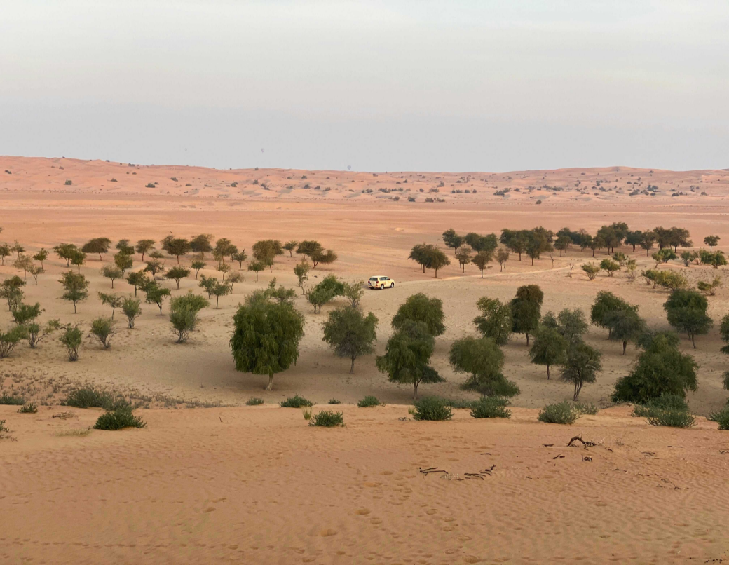
A new study published in Scientific Reports has evaluated land productivity dynamics (LPD) across the African Great Green Wall (GGW) from 2013 to 2022, offered a decade-long perspective on one of the world’s most ambitious initiatives to combat desertification in the Sahel. It aims to assess progress toward the United Nations’ Sustainable Development Goal (SDG) 15.3 for Land Degradation Neutrality (LDN) and identify the key factors driving land productivity change to guide more effective restoration strategies.
31 Oct 2025 -
 Novel Field-Theoretic Framework Unlocks Universal Evolutionary Patterns of Competitive Systems in Nature
A research team from the Aerospace Information Research Institute of the Chinese Academy of Sciences (AIRCAS), led by DENG Chubo and SUN Xian, has developed a field-theoretic framework to address this issue. Their findings, published in Scientific Reports, reveal that competitive systems universally converge to three distinct evolutionary regimes—Stable Equilibrium, Periodic Oscillations, or Progressive Dominance and Elimination. The discovery offers a robust theoretical tool to explain and predict antagonistic phenomena across disciplines.
31 Oct 2025 -
 Smart Satellite Tools Boost Forage Farming in Arid Lands
A new study in Water Research presents an artificial intelligence (AI)-powered remote sensing framework to precisely map forage cultivation potential across northern China's hs, especially the middle reaches of the Yellow River. This study identified optimal forage belts at the kilometer scale, offering robust data and decision-ready tools to support ecological protection, sustainable agriculture, and national feed and food security.
27 Oct 2025 -
 Global Study Reveals Drought Adaptability of Karst Vegetation
A recent study published in npj Climate and Atmospheric Science unveils that ecosystems with more complete ecological succession and longer duration exhibit strong adaptability to drought. Using long-term satellite imagery (2000-2019) and an advanced automated algorithm, an international research team developed an evaluation framework based on a vegetation response intensity (RI), incorporating drought stress windows and delayed vegetation response windows to assess vegetation adaptability to drought. Their findings highlight significant differences and critical mechanisms underlying changes in karst vegetation drought adaptability.
17 Oct 2025 -
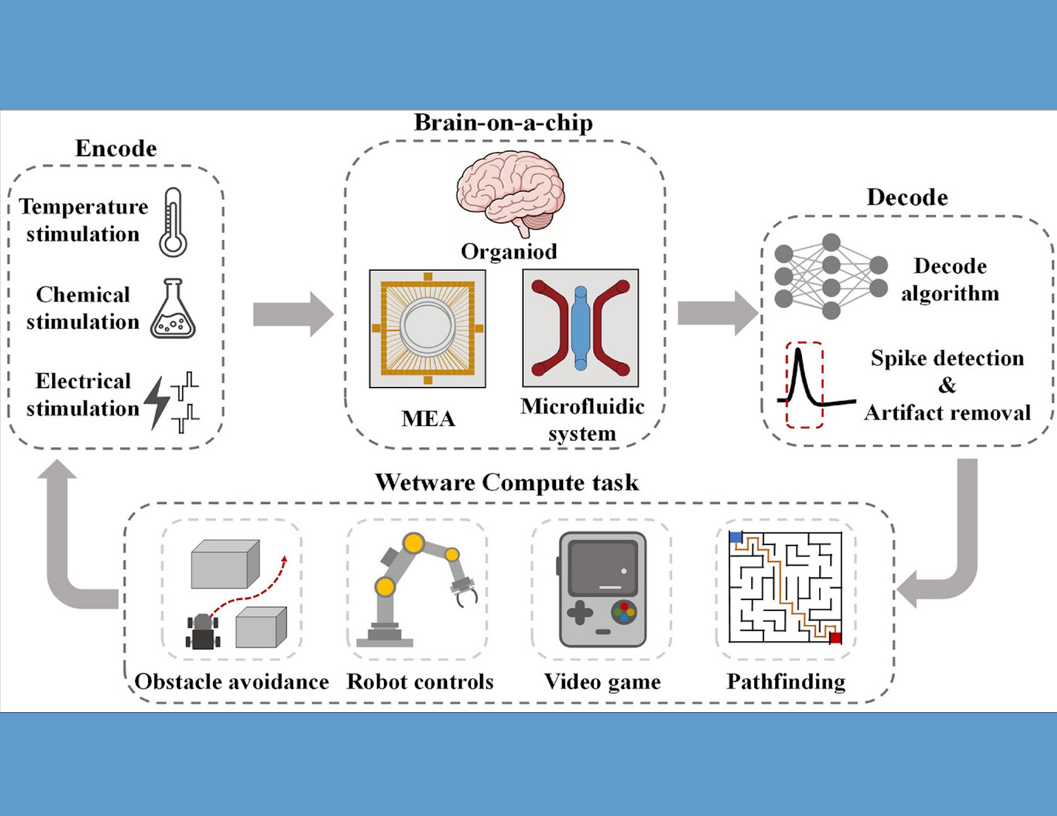 Wetware Computing Paves the Way for Low-Power AI
As artificial intelligence (AI) continues to advance, the energy demands and computational load on traditional silicon-based chips are skyrocketing. With conventional hardware approaching its physical limits, scientists are exploring novel approaches that integrate biology with technology. One promising direction is Wetware Computing, which leverages living neuronal networks to perform computations with remarkable energy efficiency and learning capability.
25 Sep 2025 -
 Scientists Develop Advanced Electrodes to Unlock Secrets of Neuronal Activity During Hibernation
A team of Chinese scientists has developed a nanocomposite-modified microelectrode array (MEA) that enables long-term, high-sensitivity monitoring of neuronal activity during hibernation—revealing how certain brain cells sustain life under extremely low metabolic states. The study could pave the way for medical advances in treating stroke and metabolic disorders, as well as innovative solutions for long-duration space travel.
25 Sep 2025

