-
 Satellite-Based Method Dramatically Improves Accuracy of Coal-fired Power Plant CO₂ Emissions Estimates
A study published in Environmental Science & Technology introduces a satellite-based method that significantly improves the accuracy of carbon dioxide (CO₂) emission estimates from coal-fired power plants. Developed by researchers at the Aerospace Information Research Institute (AIR) of the Chinese Academy of Sciences, the approach enhances our ability to track greenhouse gas emissions in near real-time—crucial for global efforts to combat climate change and achieve national climate goals.
11 Jul 2025 -
 New Satellite Mapping Reveals Vast Undetected Trees in Tropics, Highlighting Overlooked Losses
A recent study published in Nature Communications unveils that 17.31% of tropical tree cover—equivalent to 395.9 million hectares (Mha)—has been consistently overlooked by global forest monitoring systems. Using high-resolution satellite imagery (<5m) and an advanced automated algorithm, an international research team mapped previously undetected tree cover (PUTC) across pan-tropical regions from 2015–2022. Their findings highlight significant net losses and critical blind spots in current forest conservation efforts.
07 Jul 2025 -
 AI-Powered Radar Technique Reconstructs Cities in 3D with Greater Detail and Accuracy
A team of Chinese researchers has developed a powerful new method to create highly detailed 3D models of cities using radar data, helping overcome long-standing challenges in urban mapping. By combining artificial intelligence (AI) with building geometry, the new technique—called Geo-SETRA—can produce clearer, more complete images of urban landscapes, potentially transforming how cities are monitored, planned, and protected.
07 Jul 2025 -
 Haishao-1 Satellite Ushers in New Era of Low-Latitude Earth Observation
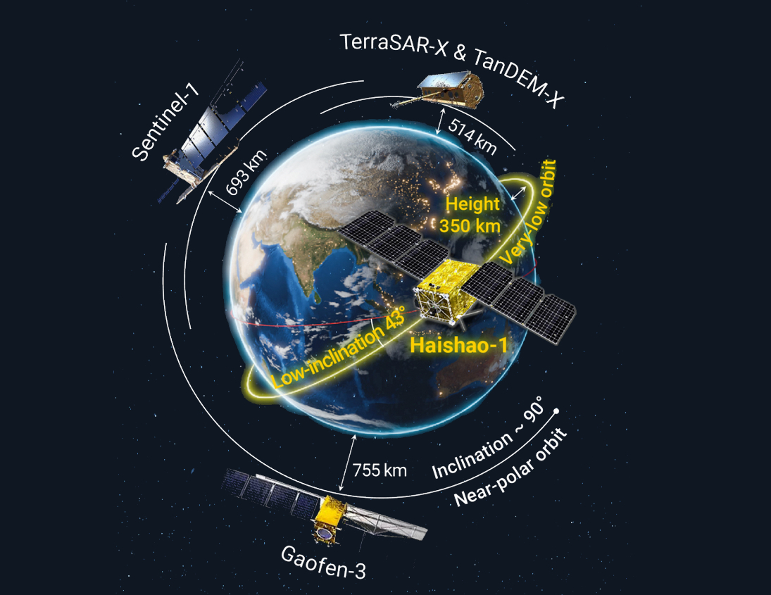
A new study published in The Innovation on May 12, 2025, highlights the launch of Haishao-1 (HS-1), China's first low-inclination orbit Synthetic Aperture Radar (SAR) satellite—marking a breakthrough in global Earth observation. Developed by the Aerospace Information Research Institute (AIR) of the Chinese Academy of Sciences, in collaboration with the Innovation Academy for Microsatellites and AIRSAT Technology Group, HS-1 combines a lightweight design with high-performance imaging capacities. Uniquely positioned in a low-inclination orbit, the satellite is specifically designed to fill long-standing observational gaps in equatorial and tropical regions—areas that are frequently obscured by clouds and under-observed by conventional polar-orbiting satellites by delivering detailed, frequent radar imagery with remarkable clarity.
30 Jun 2025 -
 Scientists Develop High-precision Methods to Monitor Global CO2 Emissions from Power Plants
A research team led by Professor SHI Yusheng from the Aerospace Information Research Institute, Chinese Academy of Sciences has developed a breakthrough solution to this problem. Using enhanced Gaussian plume model and data from NASA's Orbiting Carbon Observatory 3 satellite, the team has achieved high-precision CO2 emission estimates from 14 large coal-fired power plants globally.
18 Jun 2025 -
 China Sets New National Record with Breakthrough in Satellite-Ground Communication
China has achieved a major milestone in satellite-ground communication. A joint research team from the Aerospace Information Research Institute (AIR) under the Chinese Academy of Sciences and Beijing Rongwei Technology Co., Ltd. has successfully conducted a ground-based experiment, reaching a single-channel X-band transmission rate of 2,100 Mbps using 128QAM modulation. This marks a 75% increase over previous domestic benchmarks and sets a new national record in satellite-ground data transmission.
10 Jun 2025


