

Newsroom
-
 New Radiative Transfer Model CARE-RTM Enhances Atmosphere-Ocean Simulation with Improved Accuracy and Efficiency
Researchers from the Aerospace Information Research Institute, Chinese Academy of Sciences, have developed a new radiative transfer model named CARE-RTM that simulates the propagation of sunlight through the atmosphere and ocean with improved precision and computational speed. CARE stands for Cloud Remote Sensing, Atmospheric Radiation and Renewable Energy Application, reflecting the model's broad coverage of key research areas in Earth observation. The model provides a physical tool for extracting climate and environmental information from satellite data. The findings are published in Advances in Atmospheric Sciences.
26 Jul 2026 -
 New Satellite Algorithm Boosts Real-Time Extreme Rainfall Monitoring from FY-4B Satellite
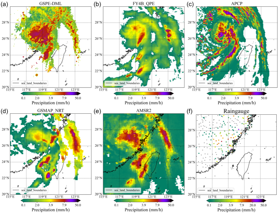
A new machine-learning algorithm could help meteorologists detect heavy rainfall more accurately and in near real time using China's Fengyun-4B geostationary meteorological satellite. Developed by a research team led by Associate Professor JI Dabin from the Aerospace Information Research Institute of the Chinese Academy of Sciences (AIRCAS), in collaboration with Associate Professor BAO Shanhu from Inner Mongolia Normal University and XIE Yanhui from the Institute of Urban Meteorology, China Meteorological Administration, the algorithm addresses two persistent challenges in satellite-based precipitation monitoring: limited information beneath cloud tops and a severe imbalance between rainy and non-rainy samples.
22 Jul 2026 -
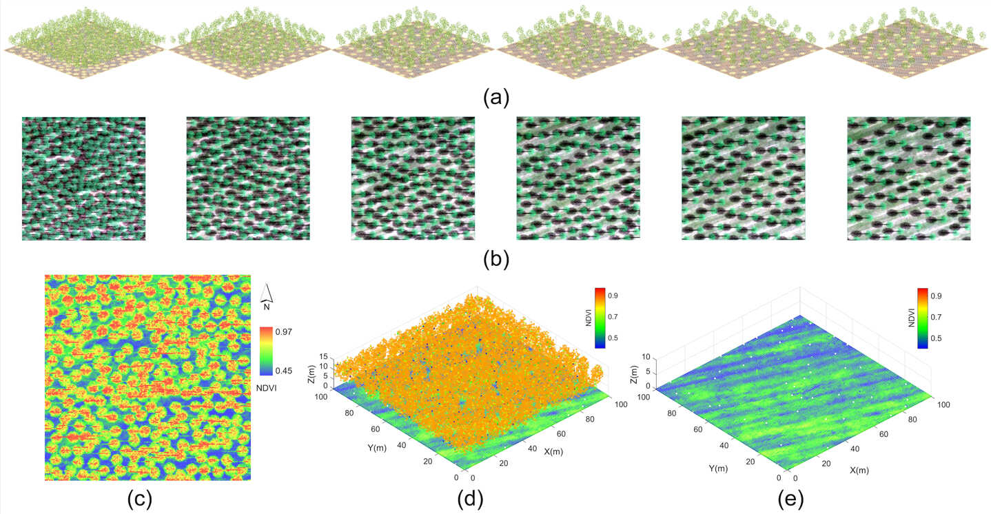 Hyperspectral LiDAR Reveals Soil Properties Beneath Vegetation Canopies
Hyperspectral LiDAR can recover soil spectral information from beneath vegetation canopies and help estimate key soil properties, according to a study published in Remote Sensing of Environment. The findings offer a new approach to monitoring soils in vegetated areas, where exposed ground is often limited or unavailable.
20 Jul 2026 -
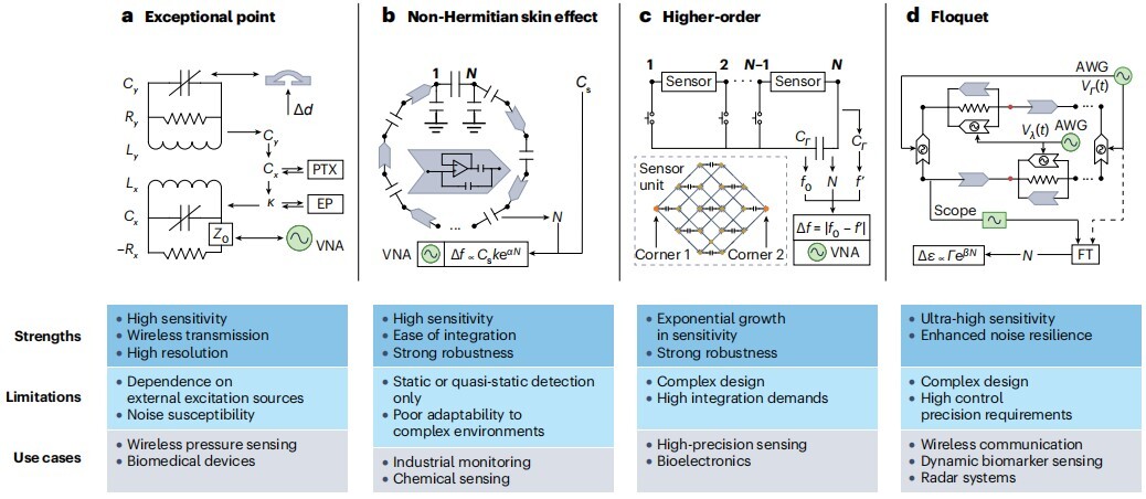 AIRCAS and Collaborators Review Advances and Future Applications in Topolectrical Circuit Engineering
Topolectrical circuits are evolving from laboratory platforms for exploring fundamental physics into practical hardware for high-precision sensing, wireless communications, memristive and neuromorphic computing, and embodied intelligence, according to a comprehensive review jointly led by researchers from the Aerospace Information Research Institute of the Chinese Academy of Sciences (AIRCAS) and the University of Chinese Academy of Sciences (UCAS), Zhejiang University, and the National University of Singapore, in collaboration with Beijing Institute of Technology and the University of Würzburg.
15 Jul 2026 -
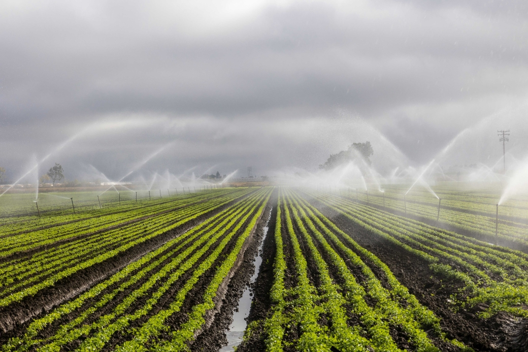 AI Method Enables High‑Resolution Mapping for China's Agricultural Irrigation Water Use Over 20 Years
A research team led by Prof. WANG Shudong from the Aerospace Information Research Institute of the Chinese Academy of Sciences (AIRCAS) has developed a new way to measure agricultural irrigation water use across China by combining satellite observations, physical laws, and artificial intelligence.
13 Jul 2026 -
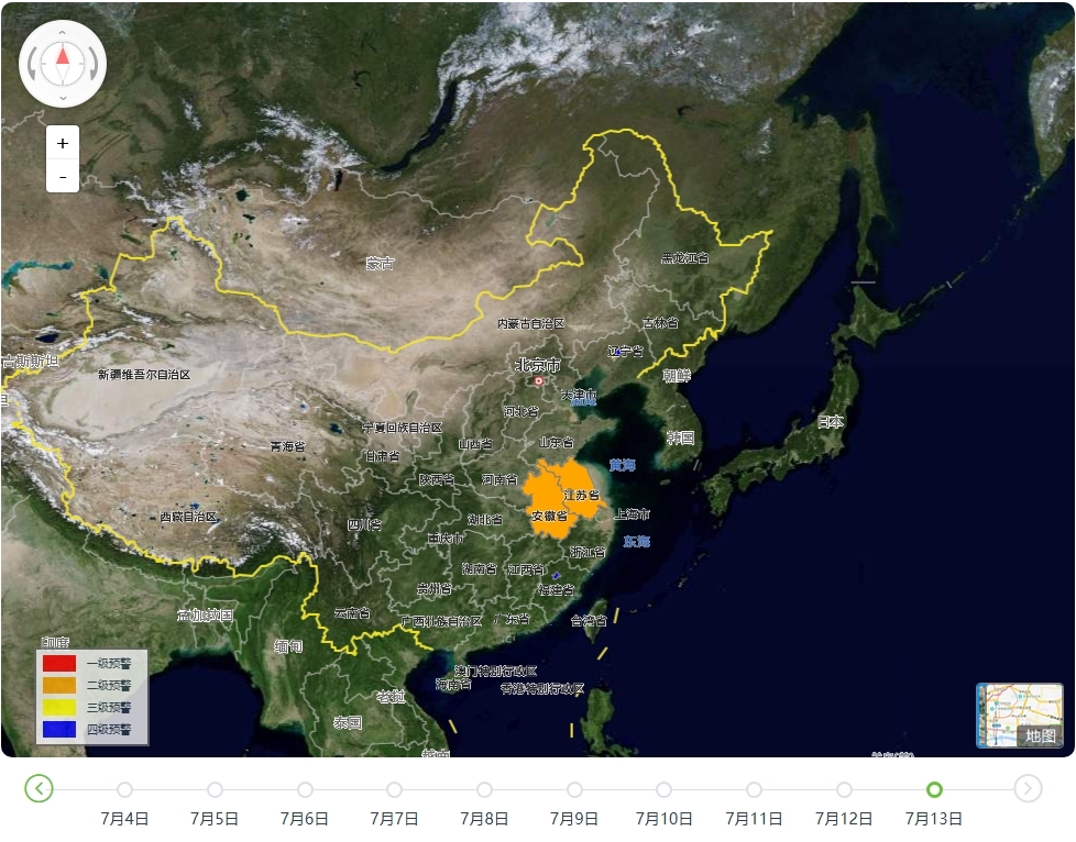 AIRCAS Launches Satellite Data Services to Support Flood Response Across China
The Aerospace Information Research Institute of the Chinese Academy of Sciences (AIRCAS) has launched a dedicated satellite data service and an integrated flood warning platform to support emergency response as persistent heavy rainfall causes flooding in several parts of China.
13 Jul 2026

