-
 Chinese Researchers Develop New Acoustic Thermometry for Rapid Measurement of Air Temperature at High Altitudes
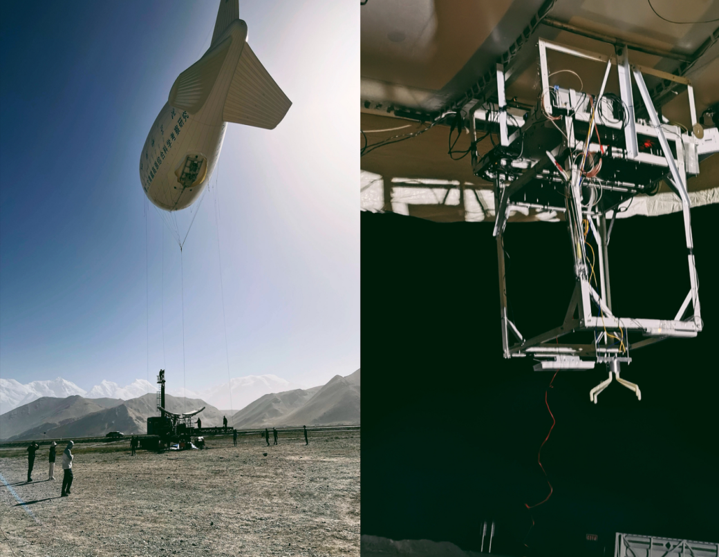
A research team at the Aerospace Information Research Institute (AIR) of the Chinese Academy of Sciences (CAS) has achieved real-time atmospheric temperature measurements at different altitudes of up to 5,200 meters using a new acoustic thermometer mounted on a tethered aerostat. Their findings were published as a cover paper in the Journal of the Acoustical Society of America.
31 Mar 2025 -
China's FengYun-3 Satellites Revolutionize Global Diurnal Land Surface Temperature Monitoring
A recent study published in the ISPRS Journal of Photogrammetry and Remote Sensing demonstrates how China's FengYun-3 (FY-3) meteorological satellites have significantly advanced global land surface temperature (LST) monitoring across diurnal cycles. Led by Prof. ZHAO Tianjie from the Aerospace Information Research Institute (AIR) of the Chinese Academy of Sciences (CAS), the research leverages the unique capabilities of FY-3's MicroWave Radiation Imagers (MWRI) to overcome limitations of traditional satellite-based LST retrieval methods.
31 Mar 2025 -
 China Unveils Lunar Radar Project to Map Geology, Aid Moon Missions
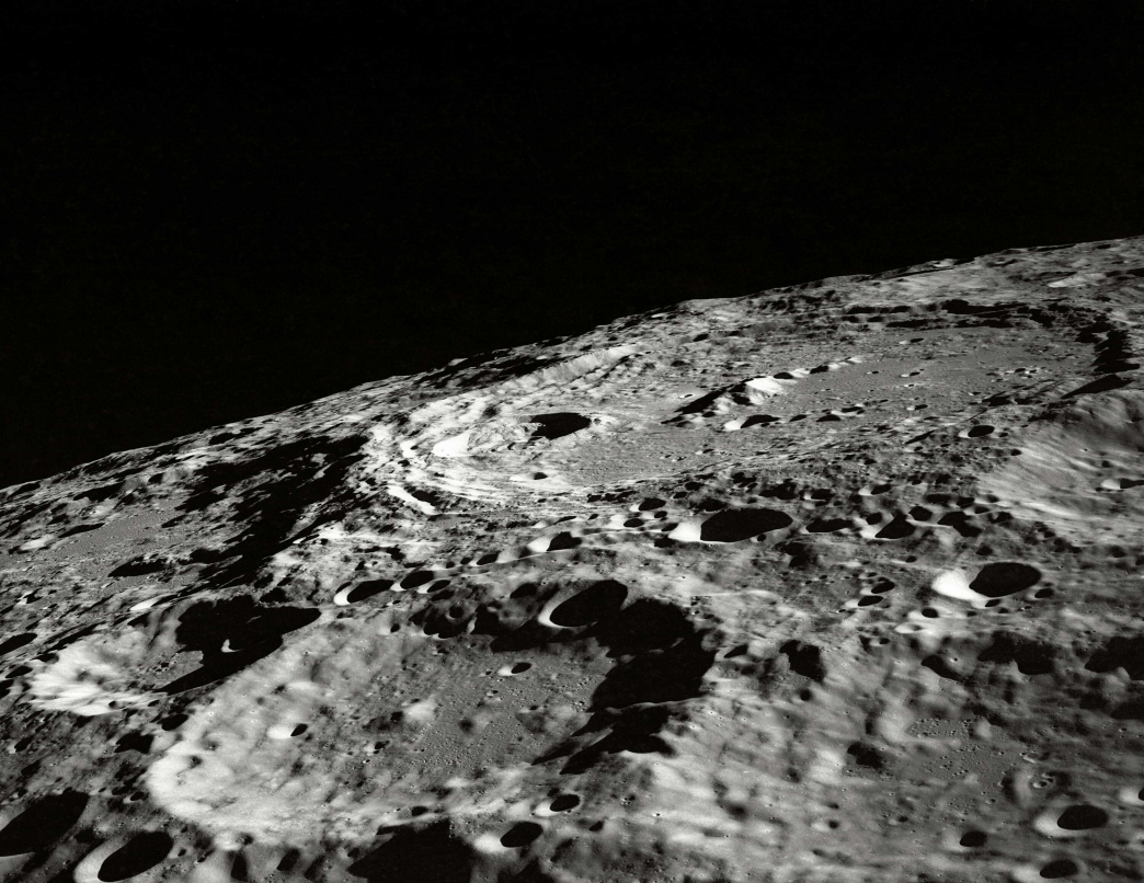
On March 5, 2025, Beijing hosted the kick-off meeting for the National Natural Science Foundation of China's major project, "Microwave Imaging Radar for Lunar Exploration and Geological Process Inversion". Led by Prof. WANG Yu from the Aerospace Information Research Institute under the Chinese Academy of Sciences (AIRCAS), this project is a pivotal initiative in China's deep space exploration efforts with the aim to advance lunar exploration through cutting-edge microwave imaging technology and geological analysis.
25 Mar 2025 -
 Scientists Develop GLOSTFM: A Breakthrough Model for High-Resolution Global Land Surface Temperature Monitoring
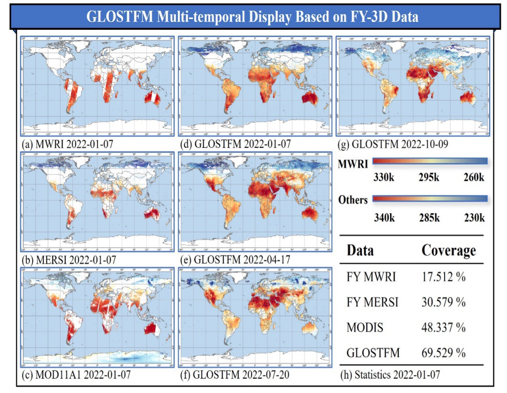
A research team led by Professor MENG Qingyan from the Aerospace Information Research Institute (AIR) of the Chinese Academy of Sciences (CAS), in collaboration with domestic and international institutions, has successfully developed GLOSTFM, a high-efficiency spatiotemporal fusion model based on multi-source satellite data. By integrating thermal infrared and microwave observations from the Fengyun-3D satellite, GLOSTFM significantly enhances the spatiotemporal resolution of land surface temperature (LST) data, providing a powerful tool for global climate change studies and urban heat island monitoring. The research findings have been published in the Remote Sensing of Environment.
21 Mar 2025 -
 Photonic Clock Chip Paves the Way for Next-Generation Ultra-Fast Computing and Communications
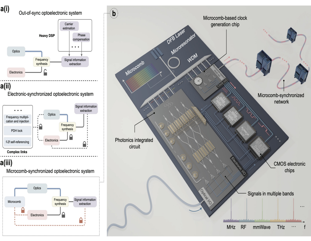
A research team from Peking University and the Aerospace Information Research Institute (AIR) of the Chinese Academy of Sciences (CAS) has developed a new photonic clock chip that offers a key advancement for future ultra-fast computing for AI development, 6G networks, autonomous vehicles, and remote sensing.
12 Mar 2025 -
 Scientists Develop Novel Method to Detect Polluted Water in Rural Areas, Tackling Algal Blooms
Chinese scientists have developed a novel method to detect and monitor polluted water in rural areas—a critical step toward tackling harmful algal blooms and contaminated ponds. By combining high-resolution satellite imagery with deep learning methods, researchers from the Aerospace Information Research Institute (AIR) under the Chinese Academy of Sciences (CAS) can now pinpoint ponds overrun by duckweed or algae with remarkable accuracy.
28 Feb 2025


