

Newsroom
-
 Chinese Satellite In-flight Calibration Research Approved by World Meteorological Organization
The World Meteorological Organization (WMO) reported in its GSICS Quarterly Newsletter (Volume 16, No. 2, 2022) the research of the in-flight radiometric calibration of Chinese wide field of view (FOV) Directional Polarimetric Camera (DPC) on-board GF5 and GF5-02 series satellites based on Rayleigh scattering method, which was carried out by a research team led by Prof. LI Zhengqiang from the National Engineering Laboratory for Satellite Remote Sensing Applications under the Aerospace Information Research Institute (AIR), Chinese Academy of Sciences (CAS).
12 Oct 2022 -
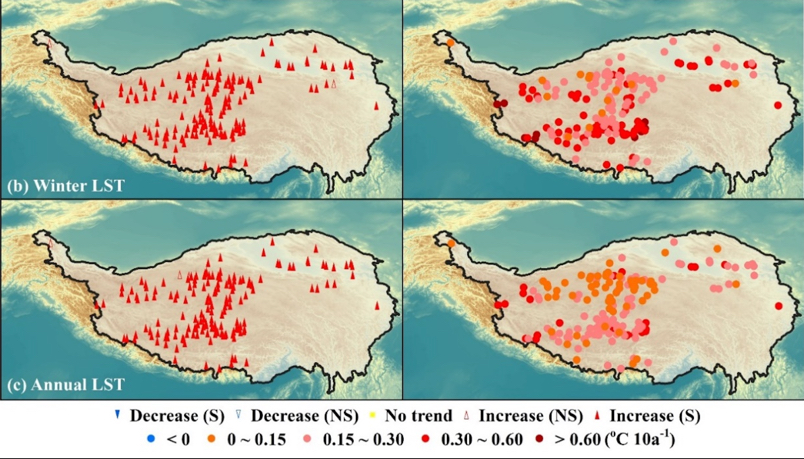 Rising Daily Surface Temperature of 160 Lakes over Tibetan Plateau during 40 Years
The annual surface temperature of 160 lakes across the Tibetan Plateau has increased significantly in the period 1978-2017, according to a study on large-scale dynamic monitoring and simulation of lake water temperature which is conducted by a research team from the International Research Center of Big Data for Sustainable Development Goals (CBAS), along with the Aerospace Information Research Institute (AIR) of the Chinese Academy of Sciences (CAS).
30 Sep 2022 -
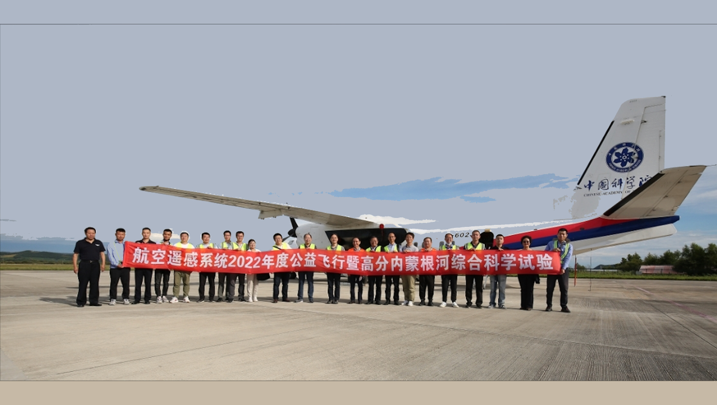 AIR Conducts 2022 Flight Experiment for Public Welfare
In a small county-level city called Genhe in the far northeast of Inner Mongolia, August saw frequently MA 60 remote sensing aircraft setting off and landing. The aircraft is part of Chinese Aeronautic Remote Sensing System (CARSS), a large research infrastructure housed by the Aerospace Information Research Institute (AIR), Chinese Academy of Sciences (CAS).
20 Sep 2022 -
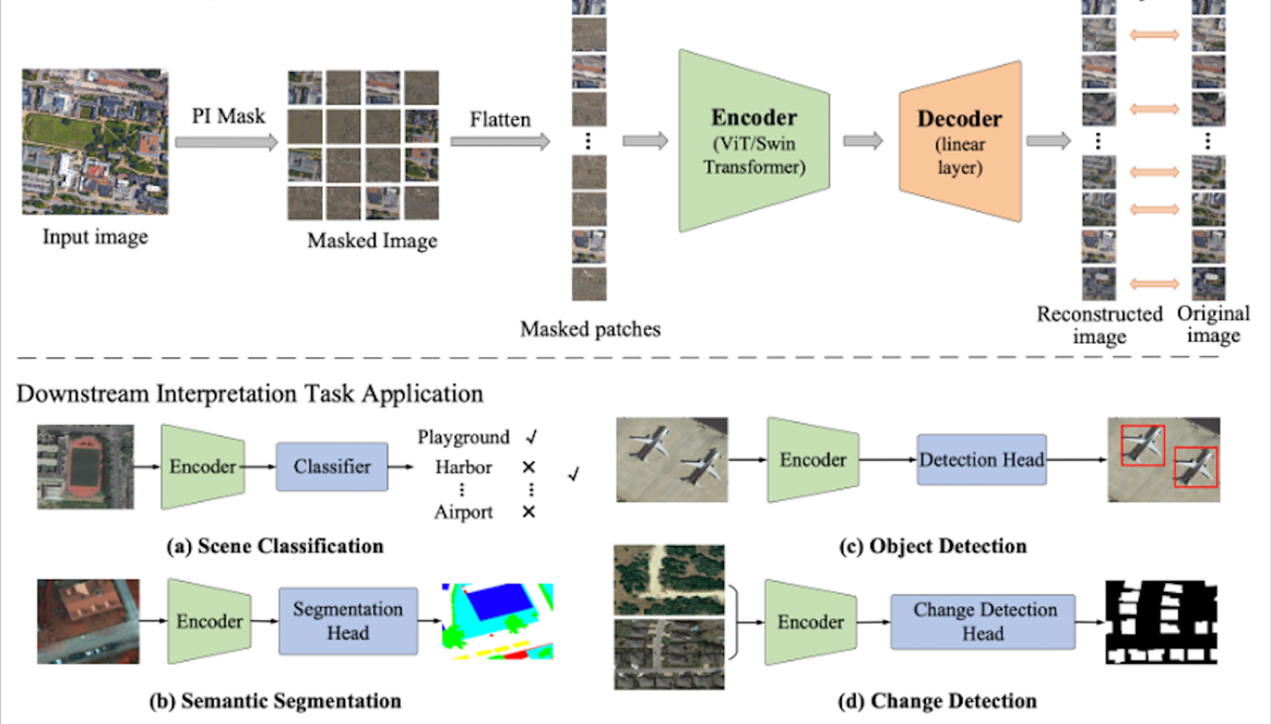 New Foundation Model Improves Accuracy for Remote Sensing Image Interpretation
A new foundation model dubbed RingMo has been developed to improve accuracy for remote sensing image interpretation, according to the Aerospace Information Research Institute (AIR), Chinese Academy of Sciences (CAS).
04 Sep 2022 -
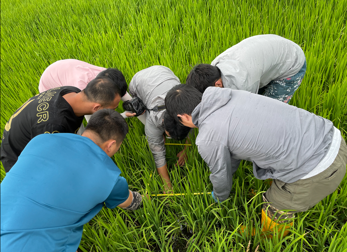 AIR Researchers Carry out Scientific Experiments and Field Surveys for Black Earth Cropland Monitoring
From July 7 to August 8, 2022, multi-dimensional field observation and scientific experiments were conducted in the black earth region of Northeast China by a research team led by Prof. LI Qiangzi from National Engineering Laboratory for Satellite Remote Sensing Applications, Aerospace Information Research Institute (AIR), Chinese Academy of Sciences (CAS).
30 Aug 2022 -
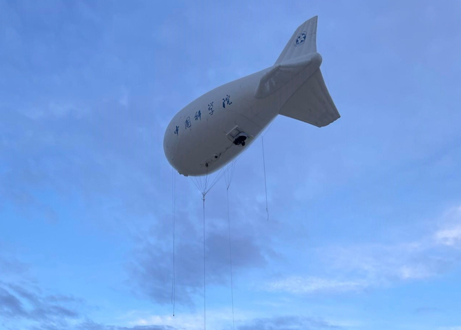 AIR Scientists Conduct Experiments on Monitoring Grassland and Livestock Resources in China
A series of integrated experiments involving unmanned aerial vehicle (UAV), tethered balloon, satellites and in-situ observation were conducted at the Shertala and Hadatu Farms in Hulunbuir Prairie of northern China's Inner Mongolia from June 21 to July 23 to collect remote sensing data and in-situ data,which were used to provide strong data support for grasslands and livestock management and monitoring.
19 Aug 2022

