

Newsroom
-
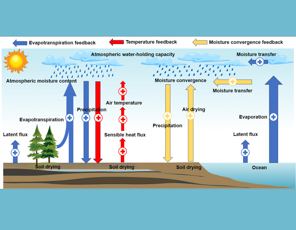 Half the World Is Drying, but Not as Models Predict: New Global Soil Moisture Study
A research team led by Prof. WANG Shudong at the State Key Laboratory of Remote Sensing and Digital Earth, Aerospace Information Research Institute, Chinese Academy of Sciences (AIRCAS), has made significant progress in reconstructing long-term global surface soil moisture variations and improving future projections through observation-constrained climate modeling. The study, Quantifying Historical and Future Surface Soil Moisture Drying Using Deep Learning and Remote Sensing, was recently published in Earth's Future .
31 Mar 2026 -
 Global Map Reveals One-third of World's Forests Disturbed in Two Decades
In a study published in Earth System Science Data, an international research team has created the first high-resolution global dataset of forest disturbance types, ---the Global Forest Disturbance Type Dataset (GFD), showing that 31% of the world's forest area, approximately 1.247 billion hectares, experienced disturbances between 2000 and 2020.
31 Mar 2026 -
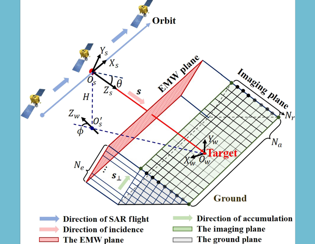 Seeing Inside Radar Images: New Method Reveals 3D Origins of Bright SAR Signals
A new SAR interpretation method helps reveal the specific sources on three-dimensional targets that correspond to strong radar scattering in SAR images. By combining a customized differentiable Synthetic aperture radar (SAR) simulator with inverse optimization, the approach links bright scattering patterns in 2-dimensional (2D) SAR images to specific 3-dimensional (3D) structures. The method could improve target analysis, image interpretation, and physically grounded SAR simulation in remote sensing.
30 Mar 2026 -
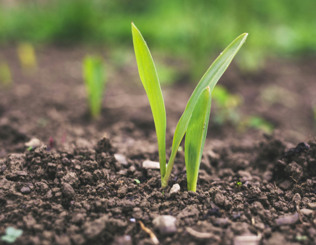 Knowledge-Guided AI Algorithm Sharpens Global Soil Moisture Maps to 5 km Resolution
A research team led by Professor ZENG Jiangyuan from the Aerospace Information Research Institute of the Chinese Academy of Sciences (AIRCAS) has developed a new algorithm that significantly improves global soil moisture observation, offering a valuable tool for agriculture, water management, and disaster early warning.
30 Mar 2026 -
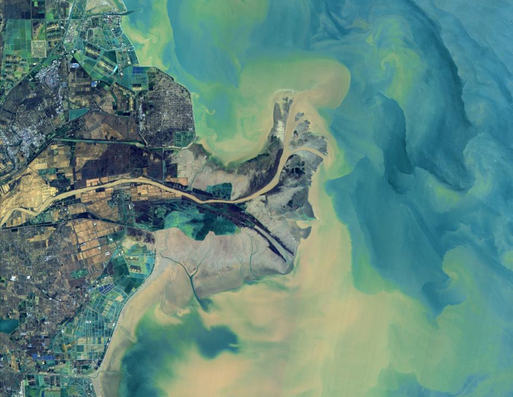 New Satellite Model Maps Yellow River's Turbidity
A new satellite-based study has reconstructed suspended sediment concentration across the Yellow River over nearly 40 years, revealing not only a long-term decline but also a recent shift in that downward trend. By combining decades of with a newly developed retrieval model, the research shows how reservoirs, tributaries, vegetation recovery, and check dams have collectively reshaped sediment patterns along one of the world's most sediment-laden rivers.
27 Mar 2026 -
 SWOT Opens New Era for Lake Monitoring
A new study shows that the Surface Water and Ocean Topography (SWOT) satellite can track lake volume changes across China with strong accuracy while greatly improving the monitoring of small lakes that were often missed before. By combining synchronous measurements of lake level and area with supporting bathymetric data, the researchers found clear seasonal patterns and an overall rise in lake volume, driven mainly by natural and larger lakes.
23 Mar 2026

