

Newsroom
-
 New Algorithm Unlocks 10-Minute Ocean Color Observations from Himawari-8
A new machine learning algorithm has enabled the Himawari-8 geostationary meteorological satellite to observe ocean color every 10 minutes, giving scientists a much sharper view of how coastal waters change throughout the day. By learning from high-quality MODIS ocean color observations, the transformer-based model overcomes key limitations of Himawari-8, including its relatively low signal-to-noise ratio, and significantly reduces retrieval errors compared with standard hourly products. The approach opens a new path for near-real-time monitoring of algal blooms, sediment transport, water quality, and other fast-changing ocean processes across the Asia-Pacific region.
08 Jul 2026 -
 Space Technologies Advance Conservation of Wudalianchi UNESCO Global Geopark
Space technologies are helping scientists unlock new insights into one of the world's most remarkable volcanic landscapes. A team from the International Centre on Space Technologies for Natural and Cultural Heritage (HIST), a UNESCO Category 2 Centre specializing in applying space technologies to the conservation and management of World Heritage sites, Biosphere Reserves, and UNESCO Global Geoparks, recently completed a five‑day remote sensing survey and geological heritage assessment at Wudalianchi UNESCO Global Geopark. The project produced high‑resolution data to support conservation, monitoring, and UNESCO revalidation efforts.
07 Jul 2026 -
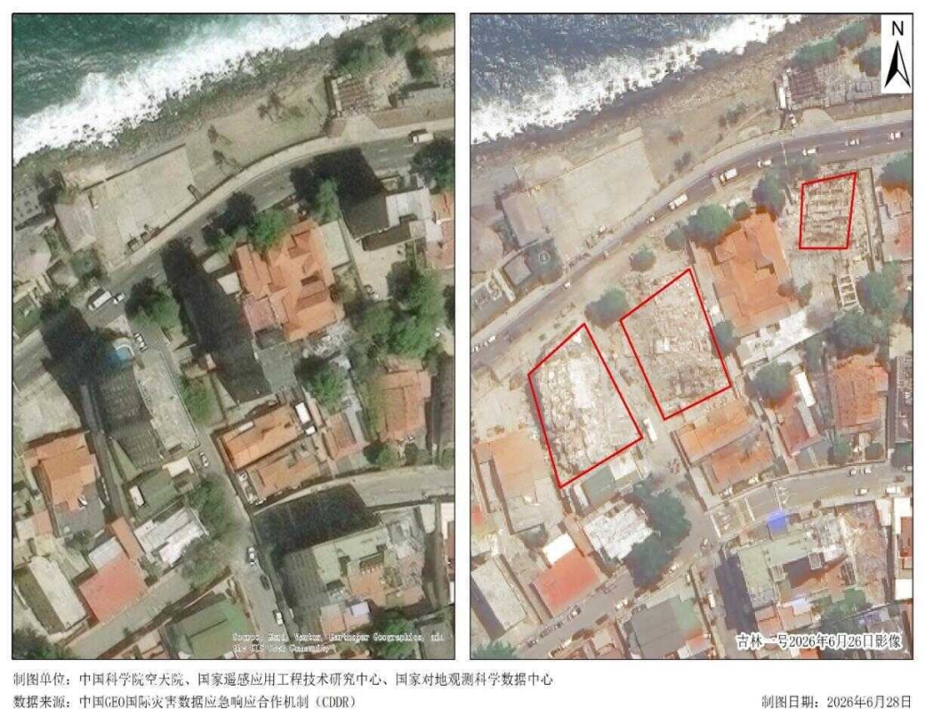 China GEO Mobilizes Satellite Support for Venezuela Earthquake Response
A 7.1-magnitude earthquake struck Venezuela on June 25, 2026, causing widespread damage in La Guaira state, north of the capital Caracas. According to figures released by the local government on July 2, the death toll had risen to 2,595 and the number of injured to 11,267.
06 Jul 2026 -
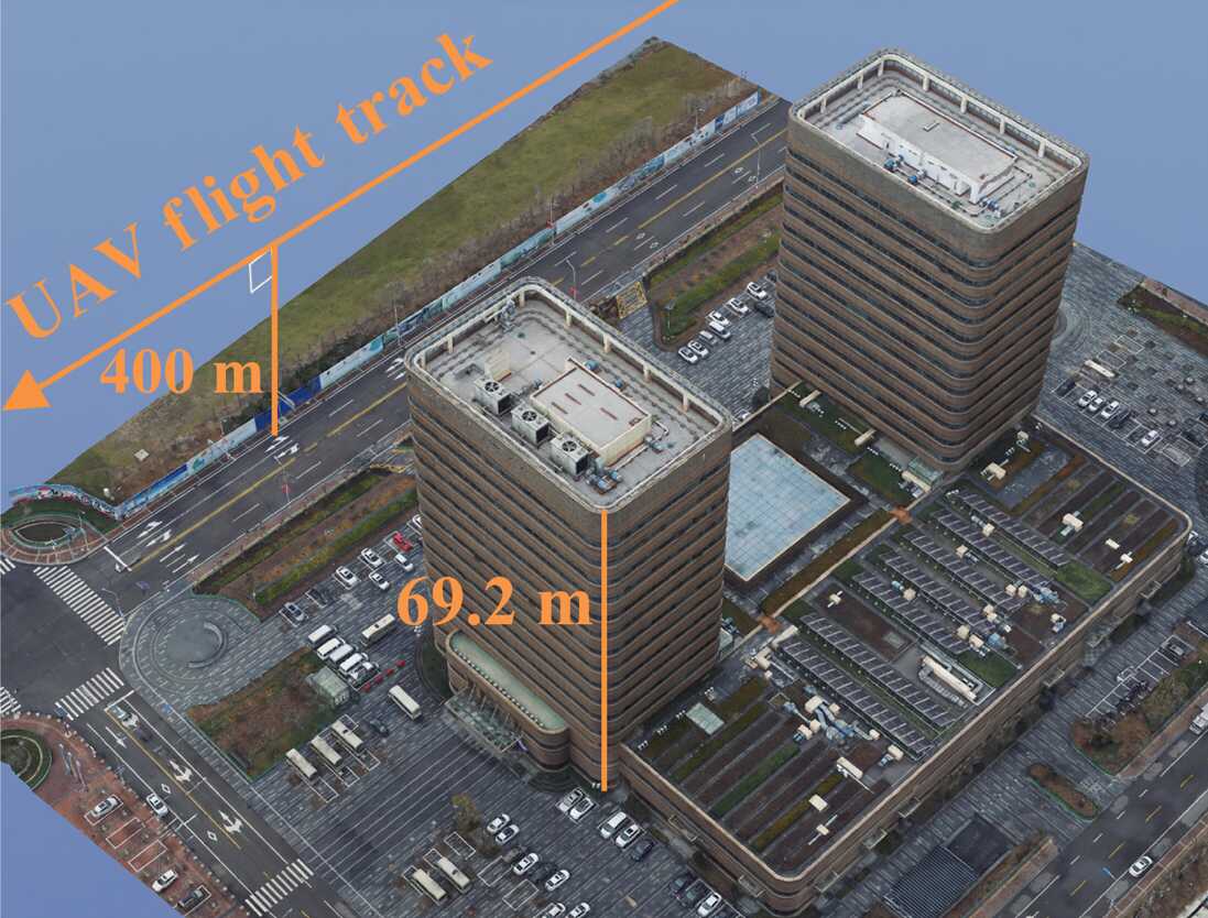 Improved 3D SAR Reconstruction for Low-Altitude UAV Platforms
A new imaging framework improves how unmanned aerial vehicle (UAV) radar systems reconstruct three-dimensional (3D) scenes in complex urban environments. By combining three-dimensional back projection with compressive sensing, the method overcomes a long-standing low-altitude imaging problem known as channel migration. The result is more accurate 3D reconstruction of buildings and ground features, with stronger resolution, lower error, and better structural recovery than conventional methods.
17 Jun 2026 -
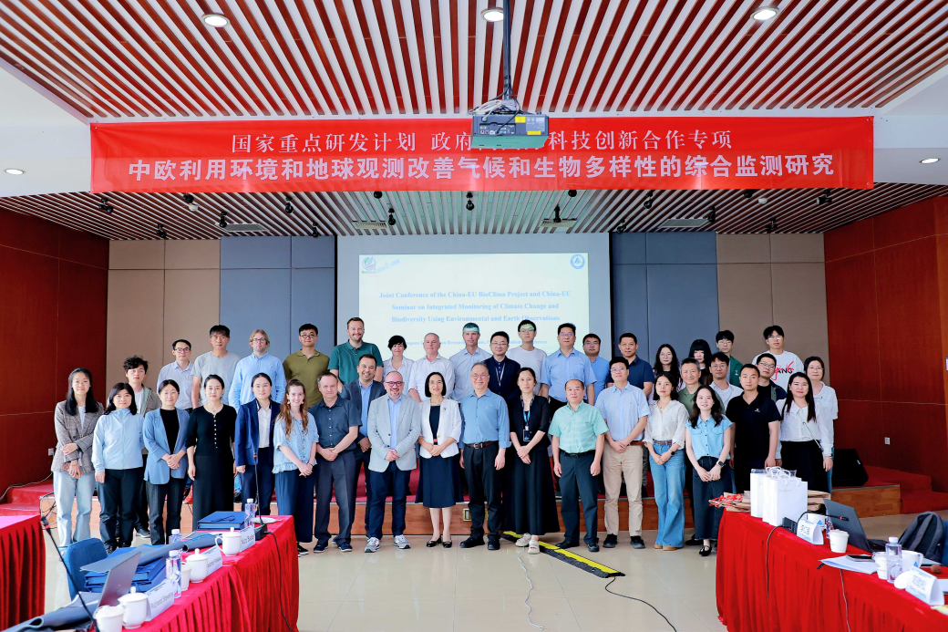 China-EU BioClima Conference Advances Cooperation on Climate Change and Biodiversity Monitoring
The China-EU joint conference of the BioClima project,“Integrated Monitoring of Climate Change and Biodiversity Improvement via Sino-European Environmental and Earth Observation", was held in Beijing on May 26, 2026. Hosted by the Aerospace Information Research Institute of the Chinese Academy of Sciences (AIRCAS), the conference brought together more than 50 experts and researchers from China and Europe to review project progress, exchange scientific findings, and explore future cooperation on climate change and biodiversity monitoring.
16 Jun 2026 -
 New Method Maps Cotton Fields in Xinjiang Months Earlier Using Plastic-Mulching Signals
Scientists from the Aerospace Information Research Institute of the Chinese Academy of Sciences (AIRCAS), in collaboration with Shihezi University, have developed a novel method to identify cotton fields in Xinjiang during the plastic-mulching stage. The study, titled "Advancing the earliest identifiable timing of cotton fields by the unique mechanized plastic-mulching practices in Xinjiang," was published in Remote Sensing of Environment.
17 Jun 2026

