-
 Sunlit Background Visible in Remote Sensing Images Controls Vertical Distributions of Stereoscopic Point Clouds in Forested Area
Forest three-dimensional structure measurement is a key factor in achieving high-precision estimation of vegetation carbon storage. Progress was made on how to use stereoscopic point cloud for forest three-dimensional structure observation,according to the Aerospace Information Research Institute (AIR), Chinese Academy of Sciences (CAS).
20 Apr 2023 -
Chinese FY-3 Satellites Enrich Global Soil Moisture Dataset
A study entitled "A global daily soil moisture dataset derived from Chinese FengYun-3B Microwave Radiation Imager (MWRI) (2010-2019)" was published on Scientific Data. The relevant dataset is available online at the National Tibetan Plateau Data Center.Dr. YAO Panpan and Dr. ZHAO Tianjie from the State Key Laboratory of Remote Sensing Science with the Aerospace Information Research Institute (AIR), Chinese Academy of Sciences (CAS) and Dr. LU Hui from Tsinghua University developed this new FY-3B global SSM product from 2010 to 2019, with a spatial resolution of 36 km.
04 Apr 2023 -
 Study Reveals Influencing Factors on Global Waste Distribution via Deep-Learning Based Dumpsite Detection from Satellite Imagery
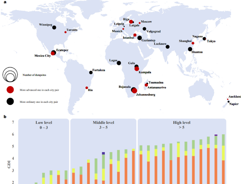
A study published in Nature Communications describes an efficient and intelligent dumpsite detection technique and analyses the correlation between the number of dumpsites and social/economic factors.This work is proposed by a research team of the Key Laboratory of Network Information System Technology at the Aerospace Information Research Institute (AIR), Chinese Academy of Sciences (CAS).
31 Mar 2023 -
 Estimating Forest Functional Diversity by Remote Sensing
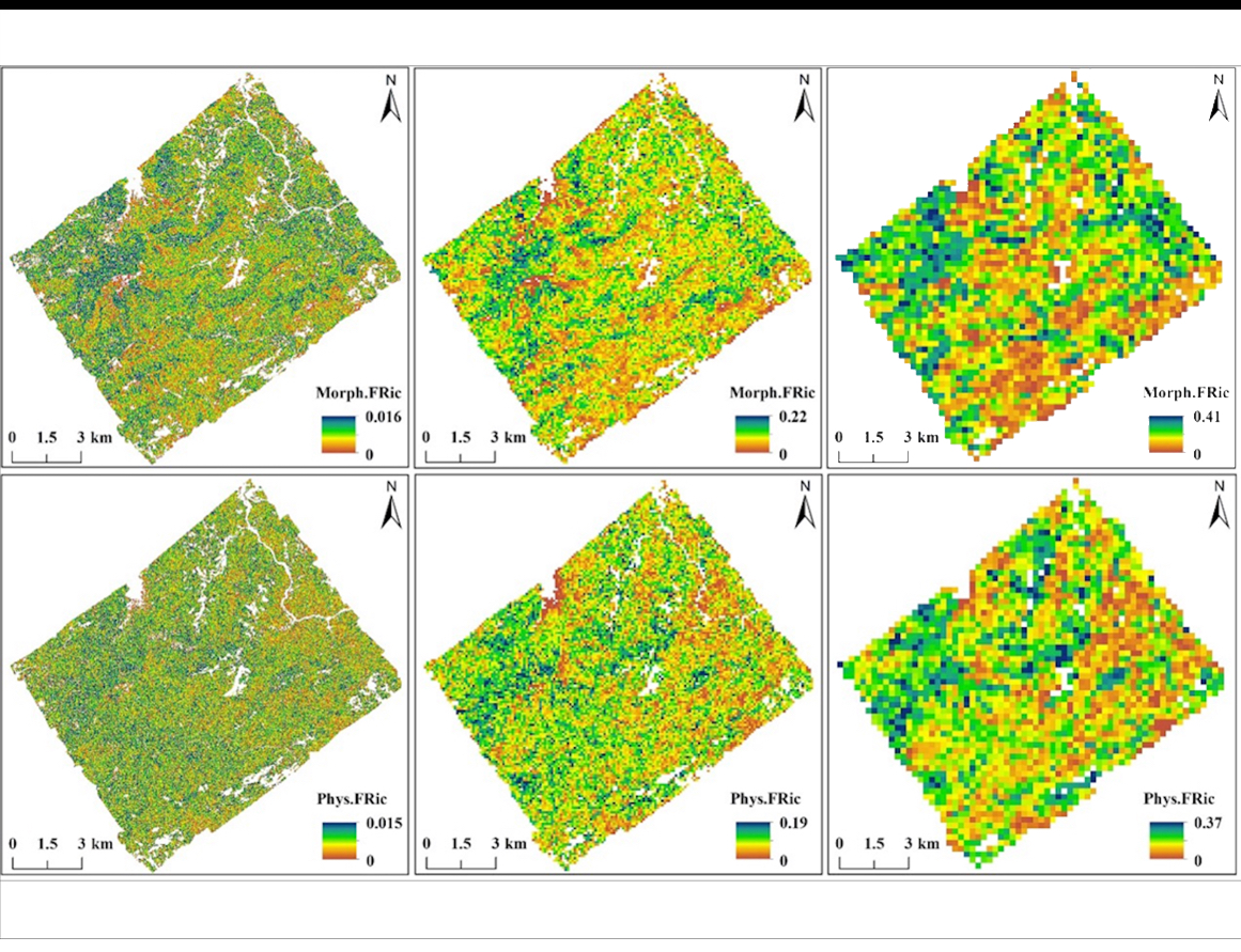
A research group led by Prof. ZENG Yuan from the Aerospace Information Research Institute (AIR) of the Chinese Academy of Sciences (CAS), in collaboration with the Remote Sensing Laboratories of University of Zurich, retrieved forest functional traits and FD from airborne LiDAR and Sentinel-2 data, and investigated forest functional diversity–productivity relationships using wall-to-wall data in a subtropical forest.
30 Mar 2023 -
 Global Fire Carbon Emissions Contribute to Increasing Atmospheric CO2 Concentrations: Study
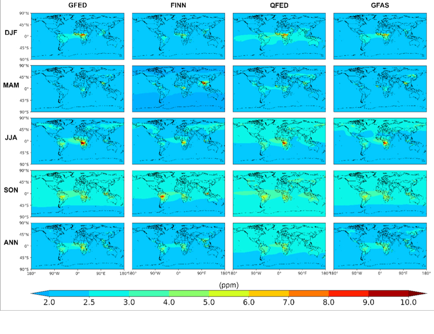
A research team led by Dr. SHI Yusheng from the Aerospace Information Research Institute (AIR) of the Chinese Academy of Sciences (CAS) quantified the impact of global fire carbon emissions on atmospheric CO2 concentrations through atmospheric transport model simulations, combined with ground-based and satellite observations validation.
17 Mar 2023 -
 Satellite Successfully Monitors Power Plant CO2 Emissions from Space
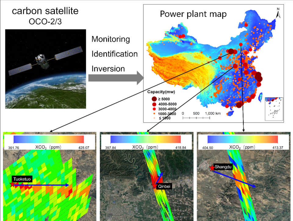
A research team led by Dr. SHI Yusheng from the Aerospace Information Research Institute (AIR) of the Chinese Academy of Sciences (CAS) developed a method for estimating CO2 emissions from coal-fired power plants based on an improved Gaussian plume model and the Orbiting Carbon Observatory 2/3 satellite.
24 Feb 2023


