

Newsroom
-
 Novel Cloud Monitoring Algorithm Promises Enhanced Accuracy
Researchers led by Professor HUSI Letu at the Aerospace Information Research Institute (AIR), Chinese Academy of Sciences (CAS), have developed a novel algorithm for measuring cloud property using neutral networks. The algorithm, known as CRANN (Cloud Retrieval Algorithm based on Neural Networks), focusing on retrieving cloud fraction and cloud-top pressure from hyperspectral measurements in the O2-O2 band. The findings were published in the journal Remote Sensing of Environment.
12 Jul 2024 -
Integrating Active and Passive Microwave Satellite Data Yields More Precise and Reliable Global Soil Moisture Mapping
Researchers from the Aerospace Information Research Institute (AIR) at the Chinese Academy of Sciences (CAS), in partnership with international colleagues, have made a stride in mapping surface soil moisture across the globe. By combining data from two advanced satellite systems—the Soil Moisture Active Passive (SMAP) and the Advanced Scatterometer (ASCAT)—they aim to provide more precise and reliable soil moisture data.
08 Jul 2024 -
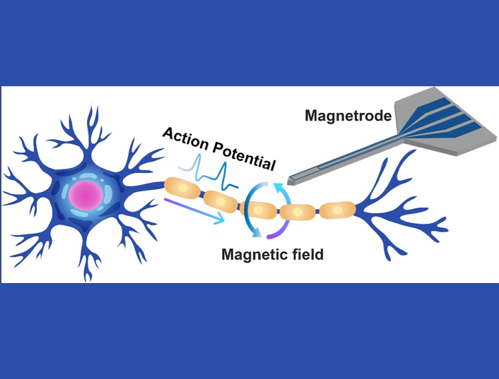 High-Sensitivity TMR-Based Magnetrodes Usher in New Possibilities for Brain Magnetic Field Detection
Researchers at the Aerospace Information Research Institute (AIR) with the Chinese Academy of Sciences (CAS) have introduced a novel TMR-based magnetrode design that aims to revolutionize local magnetic field detection in the brain. These magnetrodes, which integrate TMR sensors with needle-shaped silicon substrates, are designed to be inserted into the brain for in-situ monitoring.
03 Jul 2024 -
New Global Satellite Dataset Fixes Time-Related Errors in Vegetation Chlorophyll Fluorescence
Scientists have developed a satellite dataset that provides new insights into the global ecosystem health and productivity over the past 15 years. This new dataset, known as the Temporally Consistent Solar-Induced Fluorescence (TCSIF), offers a more reliable way to track changes in vegetation and photosynthesis across the globe from 2007 to 2021. The study, led by Professor LIU Liangyun from the Aerospace Information Research Institute (AIR) of the Chinese Academy of Sciences, was published in Earth System Science Data.
28 Jun 2024 -
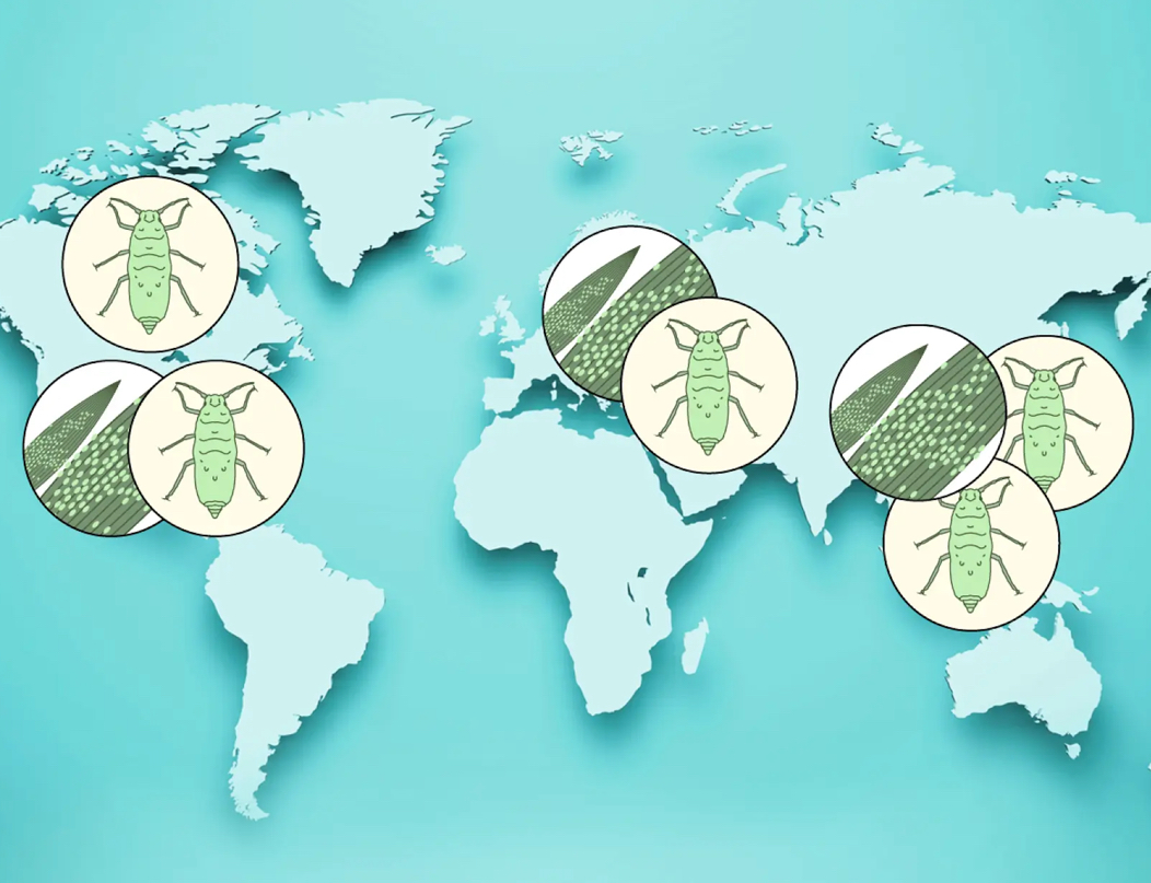 GEO Project Forecasts Global Wheat Pest and Disease Implications
The research team at the Aerospace Information Research Institute, Chinese Academy of Sciences (AIRCAS), has conducted a comprehensive remote sensing forecast for wheat pests and diseases across Asia, Europe, and North America.
22 Jun 2024 -
 New Dataset Offers Insight to Global Industrial Heat Sources
A recent study has unveiled the first comprehensive, long-term dataset of global industrial heat sources (GIHS) from 2012 to 2021. This dataset, published in the Scientific Data, was developed by a team of researchers from the Aerospace Information Research Institute (AIR) at the Chinese Academy of Sciences (CAS, offering insights into the spatio-temporal distribution of industrial heat sources worldwide.
21 Jun 2024

