

Newsroom
-
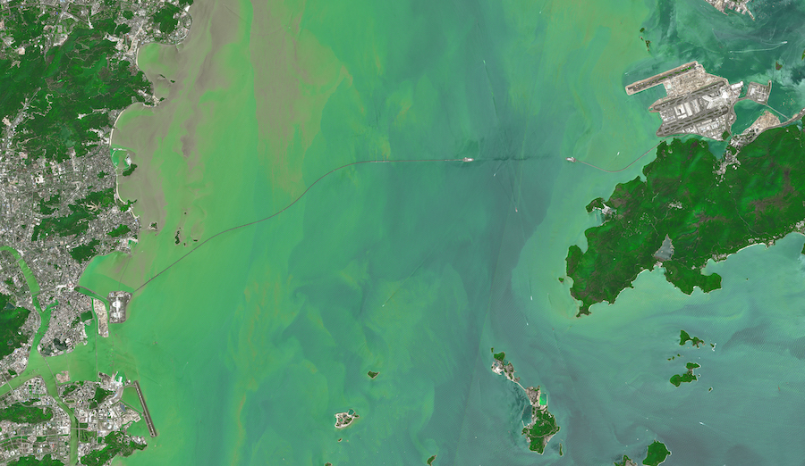 The Pearl of the Orient, Hong Kong from Space
Hong Kong, officially the Hong Kong Special Administrative Region of the People's Republic of China, also known as the "Pearl of Orient". With 7.5 million people of various nationalities in a 1,104-square-kilometre territory, Hong Kong is one of the most densely populated places in the world.
01 Jul 2022 -
BRICS Academies of Sciences Sign Beijing Declaration on Big Data for Sustainable Development
On June 16, the BRICS Academies of Sciences Beijing Declaration on Big Data for Sustainable Development was signed by the Chinese Academy of Sciences, the Academy of Science of South Africa, the Brazilian Academy of Sciences, the Russian Academy of Sciences, and the Indian National Science Academy.
22 Jun 2022 -
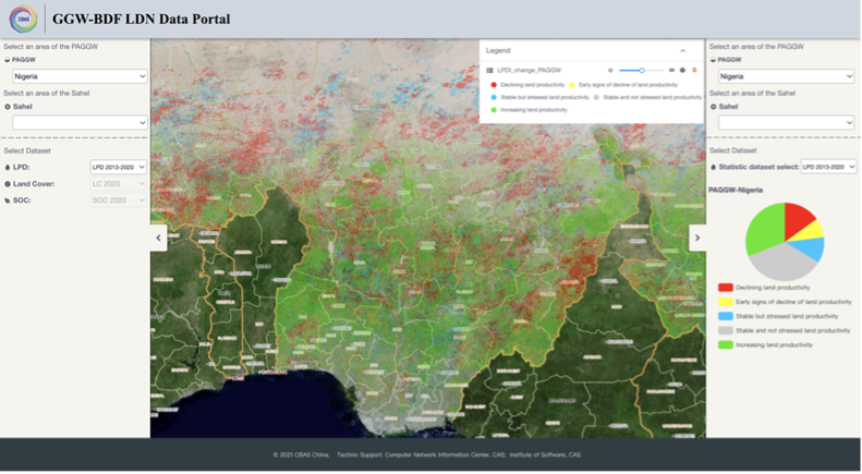 Chinese Scientists Help Africa Combat Land Degradation
On June16, the 28th World Day to Combat Desertification & Drought, China's national home event was held in Beijing, where Chinese scientists released an online tool, the Great Green Wall Big Data Facilitator, to help African countries combat increasingly severe land degradation.
17 Jun 2022 -
 HIST Holds Open Online Courses to Celebrate China's Cultural and Natural Heritage Day
On the occasion of this year's Cultural and Natural Heritage Day, the International Centre on Space Technologies for Natural and Cultural Heritage (HIST) under the auspices of UNESCO held open online courses to celebrate the day which falls on June 11,2022. The event was held in both Beijing and Hengyang, a city in Central China's Hunan Province, and was broadcast live online through Tencent Live, Bilibili Live, and other platforms, attracting nearly 72,000 people to watch online.
14 Jun 2022 -
 China's Self-developed Floating Airship Breaks Record
China's self-developed floating airship, designed for atmosphere observation, reached a record altitude of 9,032 meters in Tibet Autonomous Region on Sunday, according to its developer.
15 May 2022 -

