Earth Day is an annual event celebrated around the world on April 22 to demonstrate support for environmental protection. Growing out of the first Earth Day in 1970, it now includes events coordinated globally by the Earth Day Network in more than 193 countries. Earth Day 2020 came at a time of great challenge when human being is shadowed by and fighting against a world-wide coronavirus pandemic.
Scientists from the data processing division under the China Remote Sensing Satellite Ground Station (RSGS) present us satellite images to mark the day, providing new insight about the beauty of the planet, and telling stories of how ecological landscapes are shaped through human efforts.The data for the images are acquired with the instruments onboard GF-1, GF-2, SPOT-5, and Landsat-8.
Chaka Salk Lake, a diamond shining on the Qinghai-Tibet Plateau. (Landsat-8)
Crescent Spring looks like the desert moon. (GF-2)
Venice, the floating city. (GF-2)
Brampton Island surrounded by sparkling azure waters. (GF-2)
Niagara Falls, waterfall on the Niagara River in northeastern North America, one of the continent's most famous spectacles. (GF-2)
XiaoYingzhou Island in the heart of West Lake, Hangzhou City, China. (GF-2)
Afforestation campaign on the Loess Plateau of northern Shaanxi. Dates: July, 2005 (SPOT-5) – August, 2017 (GF-2)
Returning farmland to forest program implemented at Longjiang County, Heilongjiang of northeastern China. Dates: September, 2004 (SPOT-5) – June, 2019 (GF-2)
Focus on
Satellite Images Mark 51th Earth Day
Earth Day is an annual event celebrated around the world on April 22 to demonstrate support for environmental protection. Growing out of the first Earth Day in 1970, it now includes events coordinated globally by the Earth Day Network in more than 193 countries. Earth Day 2020 came at a time of great challenge when human being is shadowed by and fighting against a world-wide coronavirus pandemic.
Scientists from the data processing division under the China Remote Sensing Satellite Ground Station (RSGS) present us satellite images to mark the day, providing new insight about the beauty of the planet, and telling stories of how ecological landscapes are shaped through human efforts.The data for the images are acquired with the instruments onboard GF-1, GF-2, SPOT-5, and Landsat-8.
Chaka Salk Lake, a diamond shining on the Qinghai-Tibet Plateau. (Landsat-8)
Crescent Spring looks like the desert moon. (GF-2)
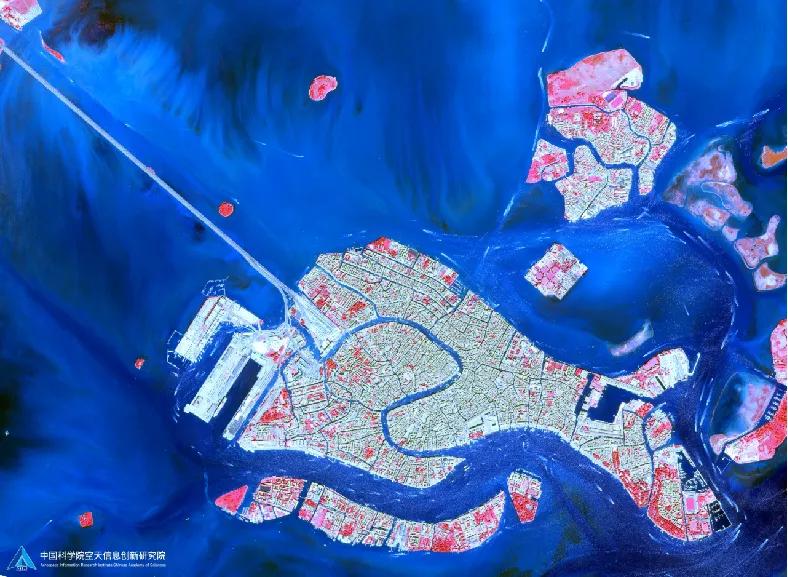
Venice, the floating city. (GF-2)
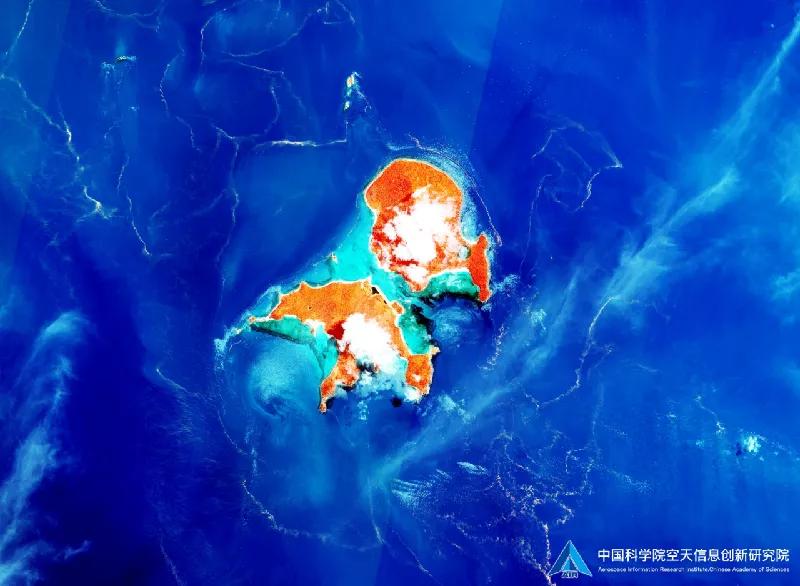
Brampton Island surrounded by sparkling azure waters. (GF-2)
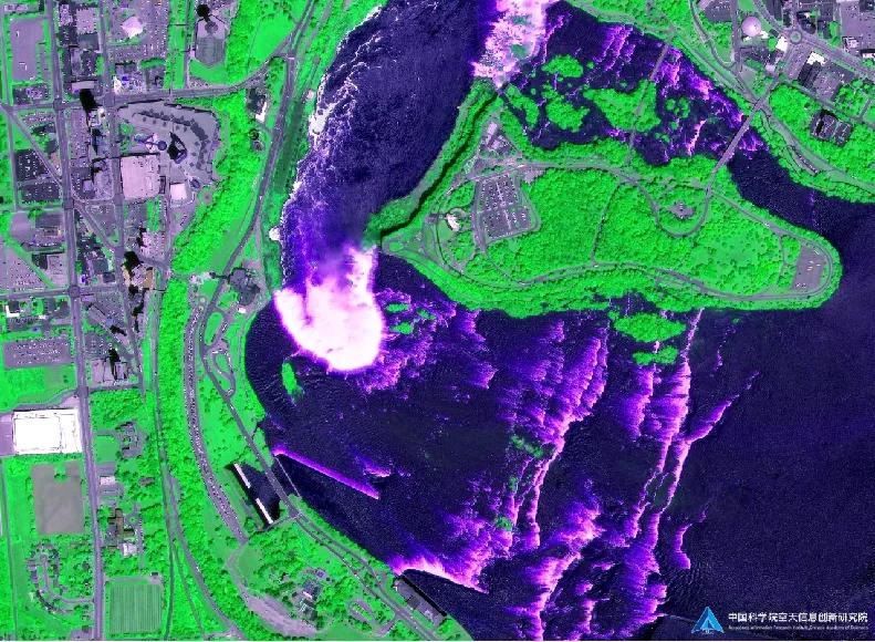
Niagara Falls, waterfall on the Niagara River in northeastern North America, one of the continent's most famous spectacles. (GF-2)
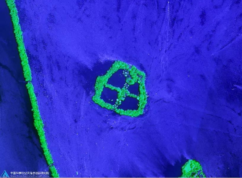
XiaoYingzhou Island in the heart of West Lake, Hangzhou City, China. (GF-2)
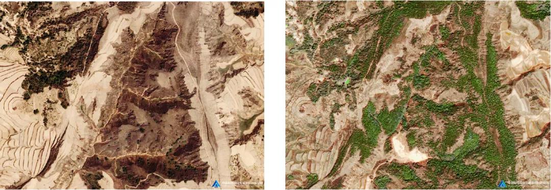
Afforestation campaign on the Loess Plateau of northern Shaanxi. Dates: July, 2005 (SPOT-5) – August, 2017 (GF-2)
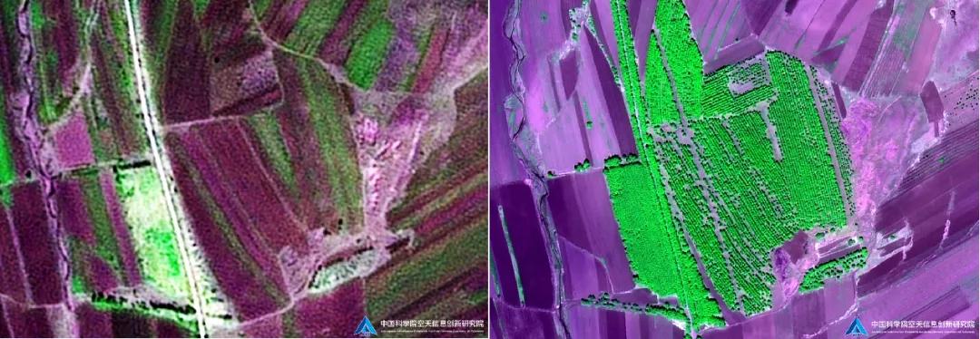
Returning farmland to forest program implemented at Longjiang County, Heilongjiang of northeastern China. Dates: September, 2004 (SPOT-5) – June, 2019 (GF-2)
Tree-planting in Kubuqi desert. Dates: June, 2005 (SPOT-5) – June, 2019 (GF-1)