New Global Wetland Maps Offer Detailed Insight into Ecosystem Health
May 08, 2024
A research team led by Prof. LIU Liangyun from the Aerospace Information Research Institute (AIR) with the Chinese Academy of Sciences (CAS) has unveiled a comprehensive set of global wetland maps, shedding light on these vital ecosystems like never before.
Wetlands are regarded as one of the world’s most vulnerable and diverse ecosystems which are crucial for maintaining ecological balance and regulating climate, but due to their complex nature, detailed maps have been scarce until now.
The team utilized Landsat imagery on the Google Earth Engine platform to create the Global 30-meter Annual Wetland Maps spanning from 2000 to 2022. These maps, covering eight wetland subcategories including inland water, swamp, marsh, flooded flat, saline, mangrove, salt marsh, and tidal flat, fill a crucial gap in our understanding of wetland dynamics on a global scale.
The study was published in Scientific Data, and the complete dataset is openly accessible at the Zenodo platform.
By leveraging a vast pool of wetland training samples and employing local adaptive classification algorithms, the researchers achieved impressive accuracy rates. The maps boasted an overall accuracy of 86.95% and a Kappa coefficient of 0.822, indicating their reliability in delineating wetland areas.
In addition, the third-party validation datasets in United States and European Union also collected and demonstrated the greatly temporal stability in wetland mapping accuracies.
To understand the performance of the time-series global wetland maps, researchers also conducted a case study of an inland wetland in Poyang Lake, China, which experiences frequent changes in wetland subcategories due to water levels and environmental factors, showing the accurate spatial distribution of four wetland subcategories (permanent water, swamp, marsh, and flooded flat) in 2000, 2010, 2020, and 2022. These maps effectively depict the varying wetland distribution patterns over time.
These newly unveiled maps are expected to provide invaluable support for wetland conservation efforts and sustainable development initiatives worldwide. By offering detailed insights into wetland dynamics over time, policymakers, scientists, and conservationists will have access to essential data to inform decision-making and prioritize conservation efforts.
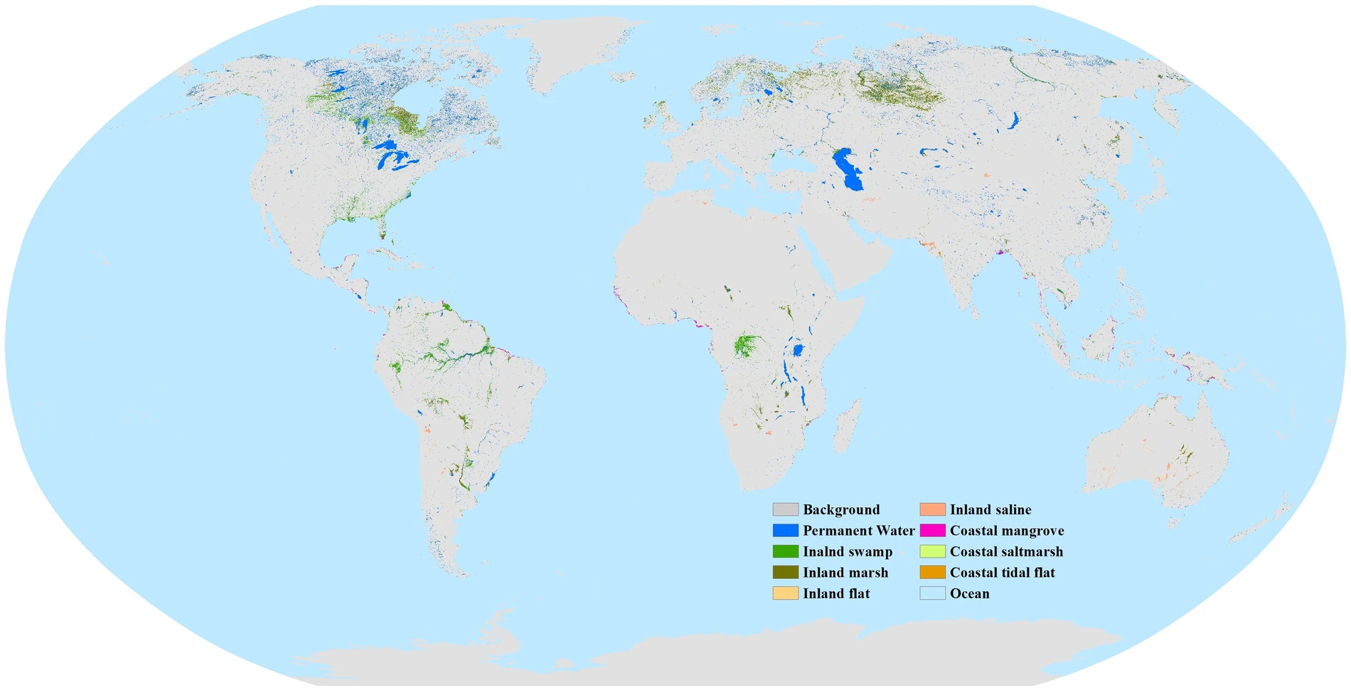
Spatial distribution of eight global wetland subcategories in 2022. (Image by AIR)
Contact: luyq@aircas.ac.cn
News & Events