Field Campaign Conducted for SDGSAT-1 TIS Radiometric Calibration
A radiometric calibration team of the International Research Center of Big Data for Sustainable Development Goals (CBAS) went to Dali, Yunnan Province to carry out the vicarious radiometric calibration experiments of thermal infrared sensor (TIS) onboard the SDGSAT-1 satellite during its on-orbit operation from December 01 to 24, 2022.
The field campaign was conducted at Erhai, Dali Bai Autonomous Prefecture, Yunnan province. Erhai is located in the subtropical monsoon area of the plateau, with obvious dry and wet climate, more heavy rain in summer and less precipitation in winter. The average temperature of Erhai for many years is maintained at about 15°C. The length of Erhai is 41.5 km from north to south, 3-9 km wide from east to west, 116 km in circumference, and 251 km2 in area. The water depth is about 10.5 m and 20.5 m in the deepest.
This experiment utilized the portable Fourier transform thermal infrared spectrometer (102F), ground-based automatic weather station, sounding radar and thermal infrared radiometer (CE312) on board solar-powered unmanned vehicle to conduct simultaneous measurements of surface and atmosphere during the satellite overpassing time, including water emissivity and radiance, aerosol optical depth, meteorological parameters, atmospheric profile (temperature, pressure, etc.). The absolute radiometric calibration of the TIS onboard SDGSAT-1 is realized by simulating the top of atmospheric (TOA) radiance through radiative transfer code.
Data collected in the field experiment would be used for the radiometric calibration and evaluation of TIS payload status. Meanwhile, it also provides technical support for the quantitative application of remote sensing data and thus providing more accurate data for the SDG-related research.
A total of 70 satellite simultaneous observations were achieved in this scientific experiment, including SDGSAT-1 satellite, FY-3E, MODIS (Terra and Aqua), Landsat 8/9 and NOAA. More than 60 satellite data were obtained without weather effects (SDGSAT-1 satellite 4 times (daytime and nighttime), 8 times FY-3E satellite, 28 times MODIS (Terra and Aqua), 3 times Landsat (2 times for Landsat 8, 1 time for Landsat 9), 19 times NOAA satellite).
The data obtained from this experiment will serve as the basis for the evaluation of the TIS payload radiometric performance of SDGSAT-1 satellite and lay a solid foundation for the high-precision quantification of SDGSAT-1 satellite products.
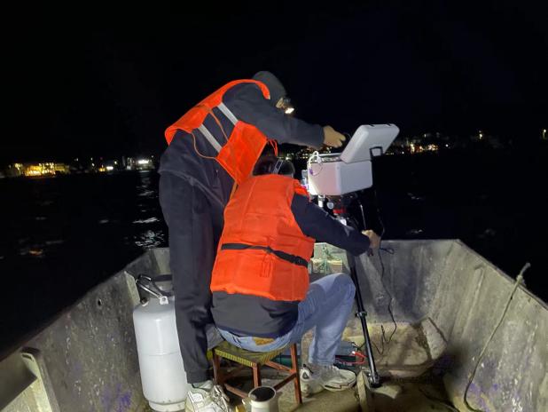
Water emissivity measurements via portable Fourier transform thermal infrared spectrometer (102F) at 21:15, 12 December 2022.
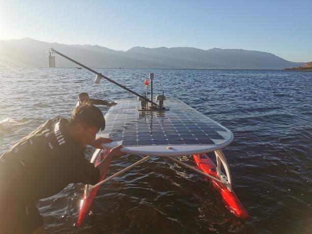
Launching the solar-powered vehicle at 09:00, 08 December 2022.
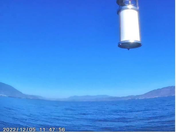
Working status of thermal infrared radiometer (CE312) onboard the solar-powered unmanned vehicle at 11:47, December 5, 2022.
News & Events