AIR Researchers Carry out Scientific Experiments and Field Surveys for Black Earth Cropland Monitoring
Northeast China, one of the world's three major black earth regions, is regarded as a major granary for the country. However, the black earth faces depletion due to years of overexploitation and overuse of fertilizer. Thus, its conservation is significant for China's grain security as well as sustainable ecosystem.
From July 7 to August 8, 2022, multi-dimensional field observation and scientific experiments were conducted in the black earth region of Northeast China by a research team led by Prof. LI Qiangzi from National Engineering Laboratory for Satellite Remote Sensing Applications, Aerospace Information Research Institute (AIR), Chinese Academy of Sciences (CAS).
This experiment was carried out with the support of the grant "Multi-dimensional Monitoring of Cropland Productivity and Ecological Sustainability" under the special project of the 14th Five Year Plan "Scientific and Technological Innovation for Black Earth Protection and Utilization".
This program aims to develop a multi-dimensional and multi-scale monitoring technological framework of cropland productivity and ecological sustainability based on the monitoring requirement of cropland infrastructure, utilization mode, productivity, efficiency, and ecological function, via the adoption of a series of monitoring technologies.
Field observations and surveys were conducted regarding the cropland quality and farmland parameters in the typical black earth areas, including Heilongjiang, Jilin, Liaoning, and Eastern Inner Mongolia.
Specifically, locations and characteristics of ditches, forests, roads were accurately recorded for the monitoring of black earth cropland scales and infrastructure; ground samples were designed of which the physiological and ecological parameters were collected for corn, rice and soybean, including canopy coverage, chlorophyll, plant height, and aboveground biomass; drones with optical camera aboard were used to obtain planting ratio and land parcel shape under different production scenarios; training and validation samples were also widely collected for accurate identification of bulk crops along the way.
The field survey invested a total of 385 person-days, with a mileage of more than 8,000 kilometers. A total number of 216 sample plots and 3867 sample sites were surveyed, and 31 drone operation grids were collected. The field survey task was successfully completed, which provided valuable data support for subsequent scientific research.
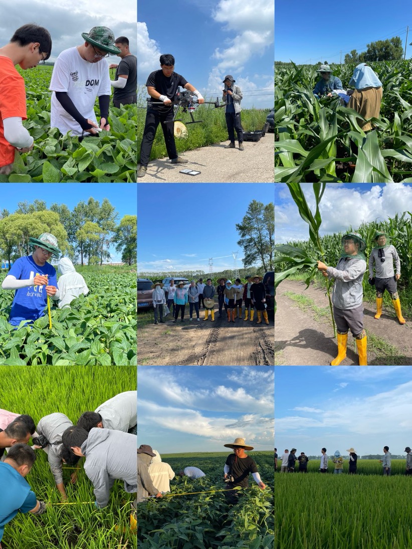
Field surveys. (Image by AIR)
News & Events