SAR Remote Sensing Facilitates Sustainability of Bagan, Myanmar
Bagan in Myanmar, also known as Pagan, is a sacred landscape featuring an exceptional range of Buddhist art and architecture. As a UNESCO World Heritage site, it is home to more than 2, 200 structures, including pagodas and temples constructed from the 10th to the 14th centuries.
However, its age, combined with the surface subsidence and earthquakes over the region have posed great threats to the stability of the historic monuments and iconic pagodas at the vast site. Thus, the monitoring of landscape surface subsidence and vulnerability of the monuments is crucial to the protection and sustainable management of the Bagan heritage site.
A research team led by Prof. CHEN Fulong from the International Research Center of Big Data for Sustainable Development Goals (CBAS), and Key Laboratory of Digital Earth Science with the Aerospace Information Research Institute (AIR), Chinese Academy of Sciences (CAS) has pinpointed several hotspots and pagodas with displacement anomalies linked to land cover change and previous earthquakes by using InSAR (Interferometric Synthetic Aperture Radar) approaches.
InSAR is a technique for mapping ground deformation using radar images of the Earth's surface that are collected from orbiting satellites. The noninvasive technology is a powerful tool to assess the vulnerability over the valuable heritage structures.
The team applied high resolution TerraSAR-X imagery acquired from 2019-2020 for deformation monitoring based on the small baseline subset and persistent scatterer InSAR approaches.
The combination of the two multi-temporal SAR interferometry approaches satisfies the two-scale monitoring requirements from landscapes to monuments, particularly for large-scale World Heritage sites.
“The non-contact monitoring method has potential when traditional methods using field accessibility and surveillance are constrained”, says Prof. CHEN Fulong.
The study is recently published in theInternational Journal of Digital Earth.

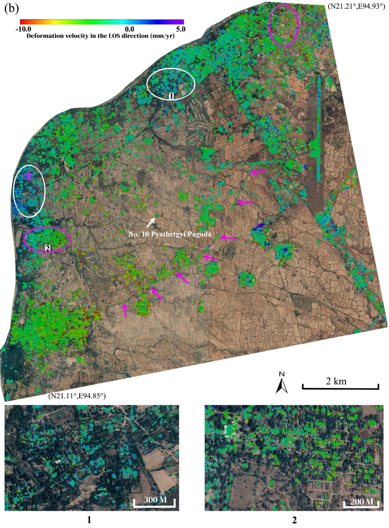
Figure 1. Deformation velocity (LOS) maps covering the cultural landscape of the Bagan site; “1” and “2” mark the presentative stable and subsidence subareas, respectively, and the pink cross marks the location of the applied reference point. (a) SBAS and (b) PSInSAR. Subsiding and stable regions are marked by pink and white ellipses, respectively. (Image credit: AIR)
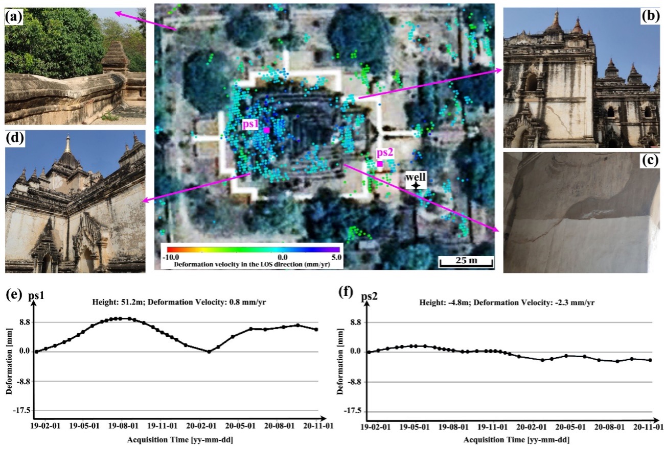
Figure 2. Structural instability observed from InSAR measurements of the Gawdawpalin Pagoda. (a) Field photographs of surface sinking, (b) and (c) cracks observed on the north-east and south-east components, and (d) stability observed on the south-west component of the temple. (e) ps1 and (f) ps2 motion time series. (Image credit: AIR)
News & Events