China GEO Supports Tonga Volcano Eruption and Tsunami Disaster Response
An underwater volcano off Tonga erupted on January 15, triggering warnings of 1.2-metre tsunami waves and evacuation orders on the shores of Tonga as well as several South Pacific islands.
Responding to requests from the United Nations Economic and Social Commission for Asia and the Pacific (UNESCAP), the South Pacific Commission (SPC) and the New Zealand Disaster Risk Agency, China GEO Secretariat activated its Disaster Data Response (CDDR) Mechanism to provide high-resolution satellite imagery in support of disaster response.
More than five China's satellites arranged the emergency observation plan for the major disaster area. Within 3 days, 39.41 GB satellite before and after-disaster data, including 1m resolution radar image (HISEA-1 satellite), 0.5m resolution optical image (BJ3A satellite), 0.98m resolution optical image (Jilin1 satellites), 10m resolution hyperspectral images (Zhuhai-1 satellites), were provided to UNESCAP, SPC, United Nations Institute for Training and Research (UNITAR), Group on Earth Observations (GEO), Committee on Data for Science and Technology (CODATA), and Institute of Physical and Chemical Research (RIKEN).
Established in 2016, the CDDR Mechanism is responsible for coordinating the provision of Chinese high-resolution satellite data and disaster analysis products to disaster-affected countries. The mechanism has been successfully activated for 29 disaster response, including Indonesia flood and landslide, Thai Flood, Nepal snow avalanche and so on in the last year.
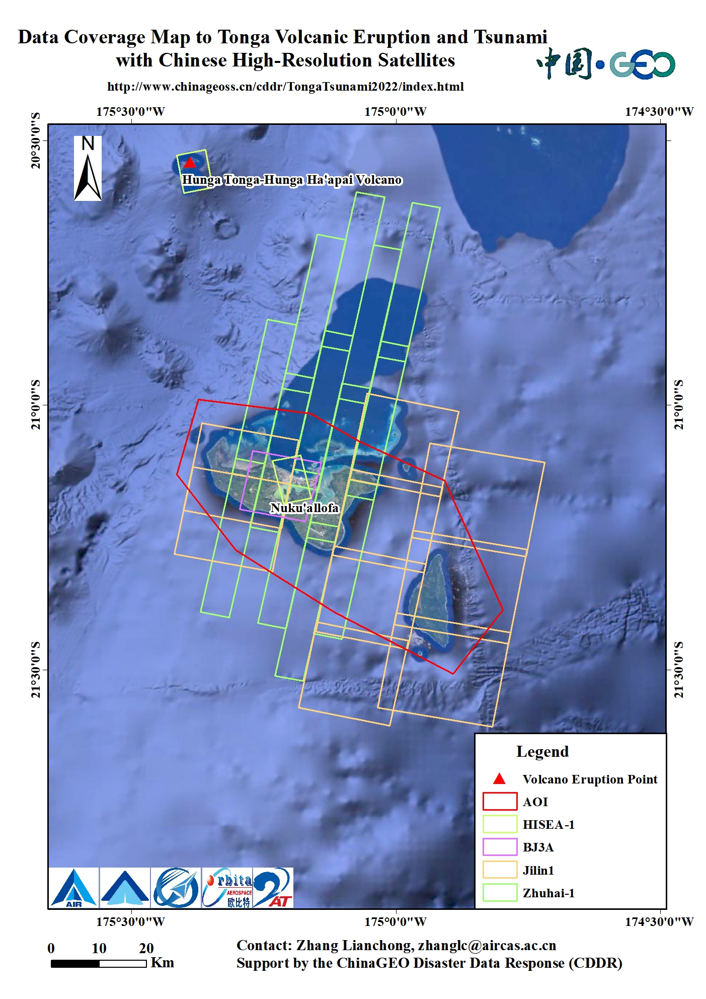
Data Coverage Map to Tonga Volcano Eruption and Tsunami with Chinese High-resolution Satellites. (Image by Aerospace Information Research Institute).
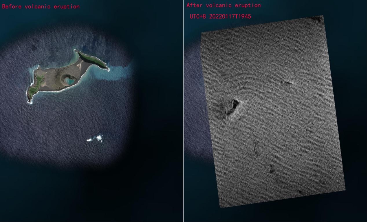
1m SAR post-disaster image of Hunga Tonga-Hunga Ha'apai volcano. Source By: HISEA-1 satellite
News & Events