Airborne Remote Sensing Experiment Completed on Home-grown MA60 Aircraft
With the landing of a MA60 aircraft, a comprehensive remote sensing experiment wrapped up in Rizhao, Shandong Province on November 30, 2021.
Starting from November 7, the mission lasted for 24 days. Eight flights covering more than 10,000 square kilometers were carried out in Rizhao City, east China's Shandong Province, bringing back data in visible light and SAR, which will provide solid support to civil applications and scientific research such as multi-band/multi-polarization SAR data fusion, ground object classification, quantitative analysis of target characteristics, high-precision extraction of typical surface elements, safety risk prediction and early warning along the high-speed railways.
The MA60 aircraft is part of China's Airborne Remote Sensing System (ARSS), a national major S&T infrastructure hosted by the Aerospace Information Research Institute (AIR), Chinese Academy of Sciences.
ARSS consists of two medium-sized manned aircraft together with a range of remote sensing technologies developed by AIR. The two MA60 aircraft consist of a remote sensing platform with complex modification, multiple equipment, and high observation efficiency. They can load, at the same time, radars and optical devices synchronously on board.
ARSS, which is integrated with SAR, infrared, Lidar and optical aeronautical equipment, also incorporates the functions of real-time processing and satellite communication, contributing to emergency-response operations, including disaster prevention and reduction.
According to the Airborne Remote Sensing Center with AIR, more airborne remote sensing missions will be carried out over this area based on ARSS, and the other MA60 remote sensing aircraft, which carries multi-band SAR and hyperspectral equipment, will be taken as the flight platform.
With the help of this integrated airborne experiment platform, scientists can obtain more kinds of comprehensive scientific data under multi-temporal, multi-payload, multi-viewing angles, multi-altitude and multi-control flying conditions in varied regions.
Based on acquired data, a standard and quantitative scientific dataset of aerial remote sensing time series will be produced for agriculture, disaster reduction, ecology, urban development, and other research purposes.
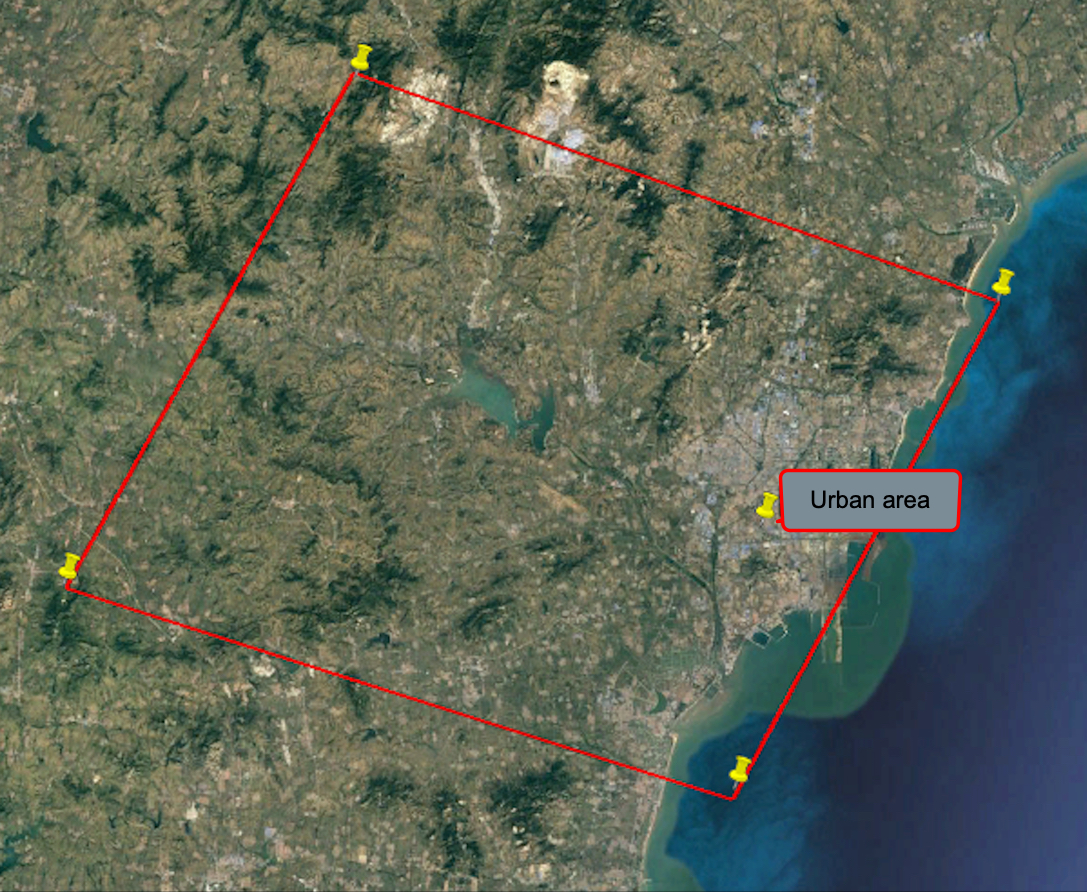
The experiment area in Rizhao, Shandong. The area covers typical surface types including urban construction land, sea, arable land, forest, grassland, wetland, railway, and port. (Image by AIR)
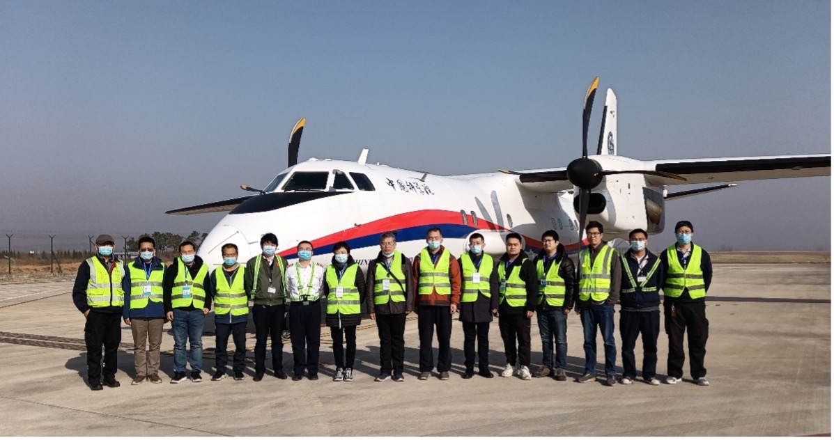
Part of experiment crew by MA60 before taking off. (Image by AIR)
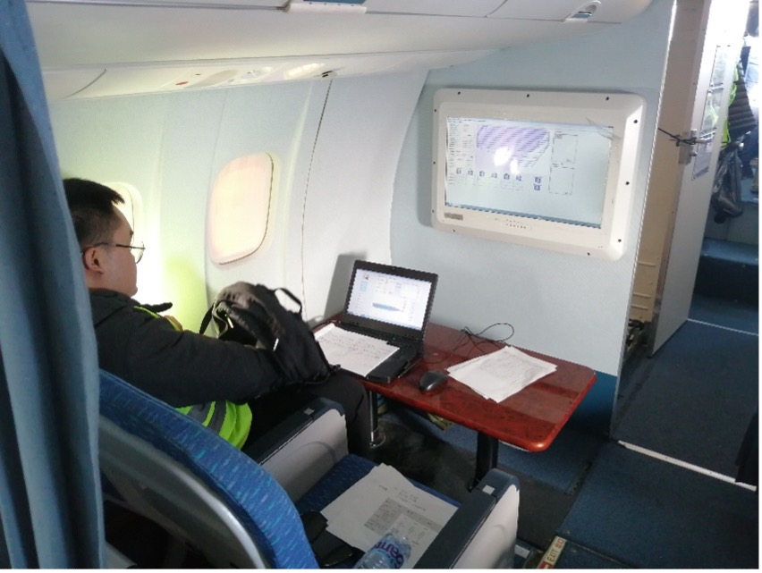
A researcher on board focusing on real-time monitoring.(Image by AIR)
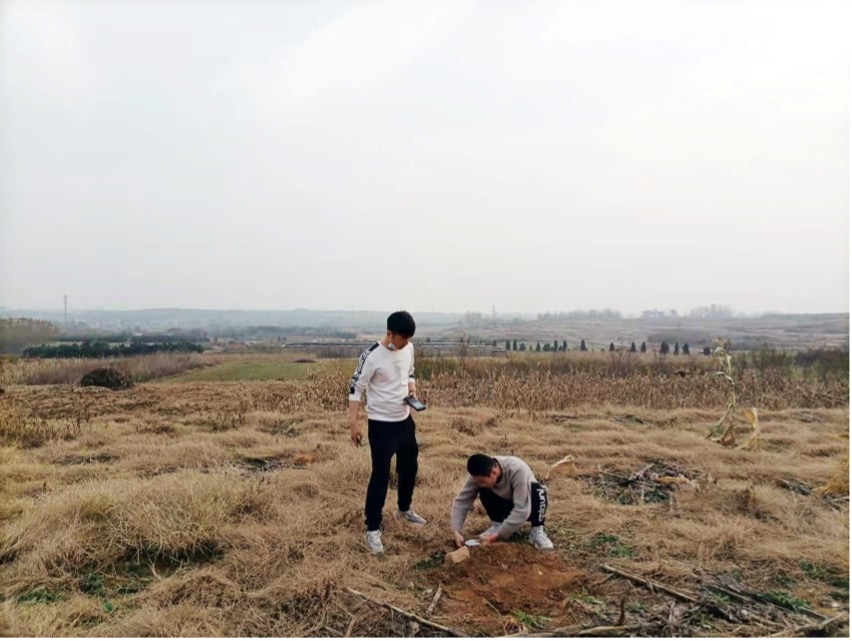
Two crew placing ground equipment. (Image by AIR)
News & Events