Satellite-airborne-ground Synthesis Experiment Validates China's Gaofen Products
A satellite-airborne-ground synthesis experiment was conducted in Huailai from July 13 to October 1, 2021, covering an experimental area of 900 km2 surrounding the Huailai Remote Sensing Comprehensive Test Site in Hebei province. The experiment was organized by the State Key Laboratory of Remote Sensing Science in partnership with 11 research institutes or universities, and involved more than 100 technicians.
The objectives are to support the key technology research in the validation of China’s Gaofen remote sensing satellite products, to develop the satellite remote sensing physical model, and to validate the remote sensing products. And thus, active-and-passive remote sensing, full-wave-covered spectrum, and integration of the satellite-airborne-ground platforms have been designed in this experiment.
Different land covers around the Guanting reservoir including croplands, forest, wetland, grassland, desert, waterbody, and mixture land cover have been selected for the multi-scale observations from satellite-airborne-ground platforms.
An optimal ground sampling method has been developed to capture the land surface key parameters’ spatial-temporal heterogeneity over different spatial scales at the same time. It meets the observation requirements at the spatial scales of 1000m, 500m, 50m, 16m, 8m, and 4m. And the plan was formulated for multi-platform and multi-scale observations over ground-airborne-satellites.
The plane has boarded multi-spectral camera, Hyperspectral imager, Lidar, Mid-infrared and thermal infrared imager. The flight area covered 900 km2 surrounding the Guanting reservoir. The unmanned aerial vehicle has boarded multi-spectral camera, hyperspectral imager and Lidar, covering the 4 km2 core areas surrounding the Huailai remote sensing test site, Yeyahu wetland park and TianMo respectively. The ground-based-observations teams have been grouped into 8 teams for the geometric parameters measuring, land use and land cover survey, forest sampling, ground spectra measuring, emissivity and temperature measuring, vegetation structural and physiochemical parameters measuring, water quality parameters measuring, and meteorological observation to collected the 32 land surface key parameters, covering 1532 samples in total.
This experiment is one of the five satellite-airborne-ground synthesis experiments designed in the project key technology and standards for Gaofen remote sensing common products validation in the China high-resolution earth observation system, which will support the key technology research of remote sensing products validation. The experiment data will be shared on the service platform of the Gaofen common products and validation.
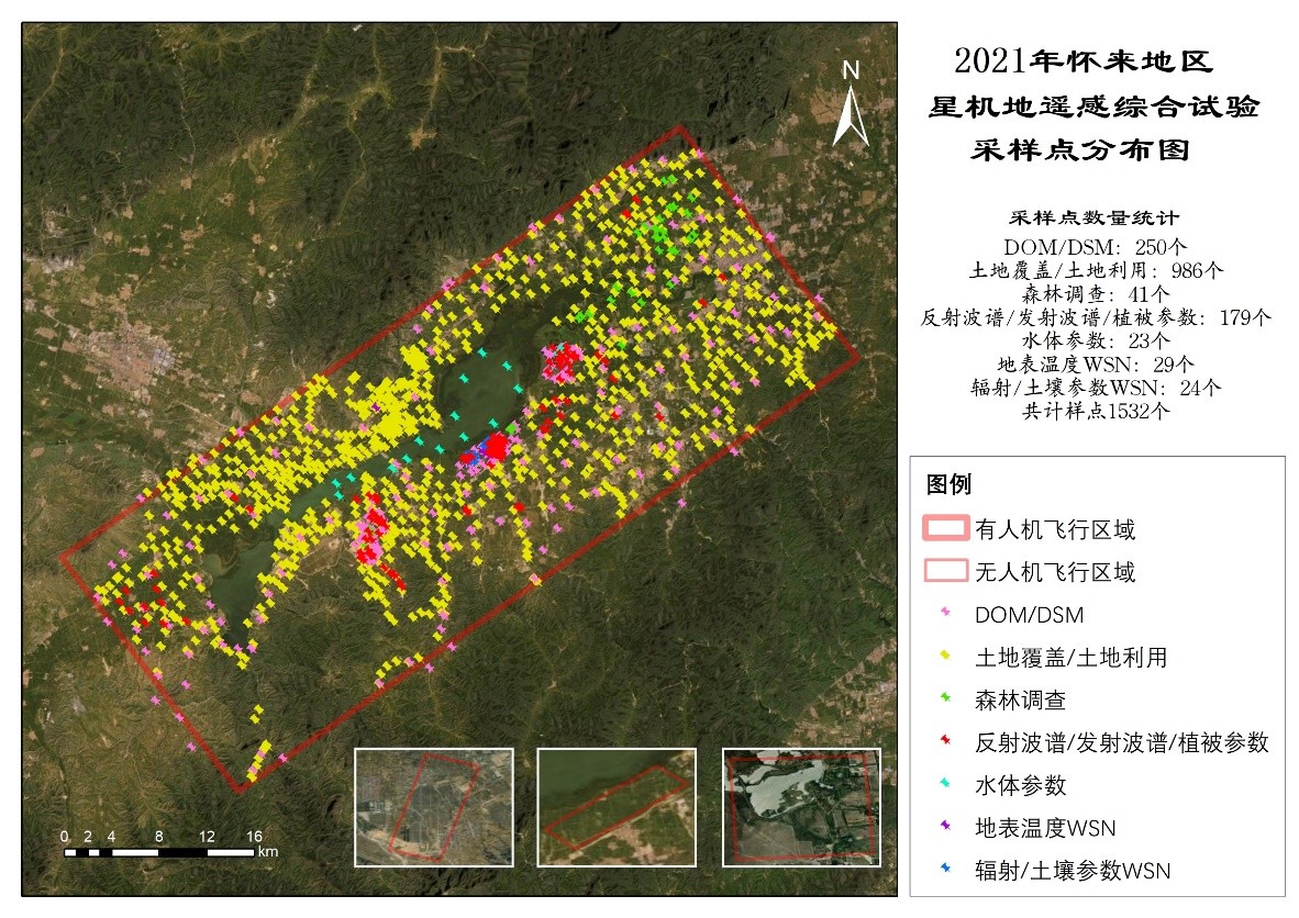
Area of Huailai satellite-airborne-ground synthesis experiment and sample distribution.
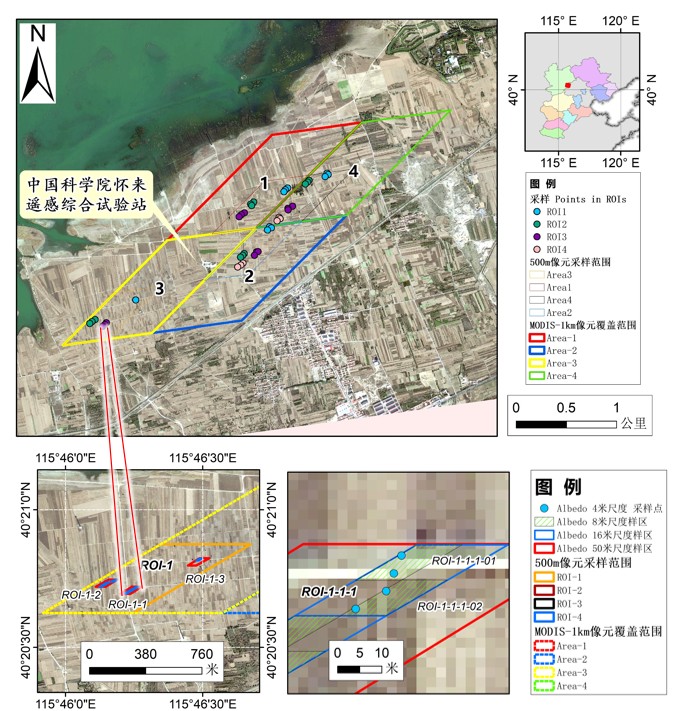
The flowchart of the multi-scale sampling method.
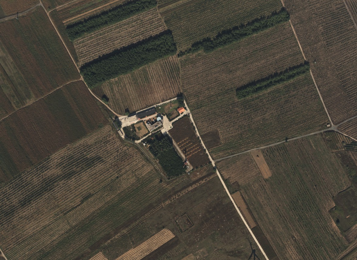
The multi-spectral imager on the near Huailai test site.
News & Events