AIR Builds Ground Network to Validate Satellite Vegetation Products
A ground network, which contains a canopy analyzer and a leaf area index (LAI) wireless sensor system has been built and passed the acceptance check, according to the National Engineering Laboratory of Remote Sensing Satellite Applications at the Aerospace Information Research Institute (AIR) on September 14, 2020.
As part of the common application platform in support of the major project “national civil space infrastructure of land observation satellites”, the network allows the platform to conduct the validation of vegetation products derived from China’s land satellites.
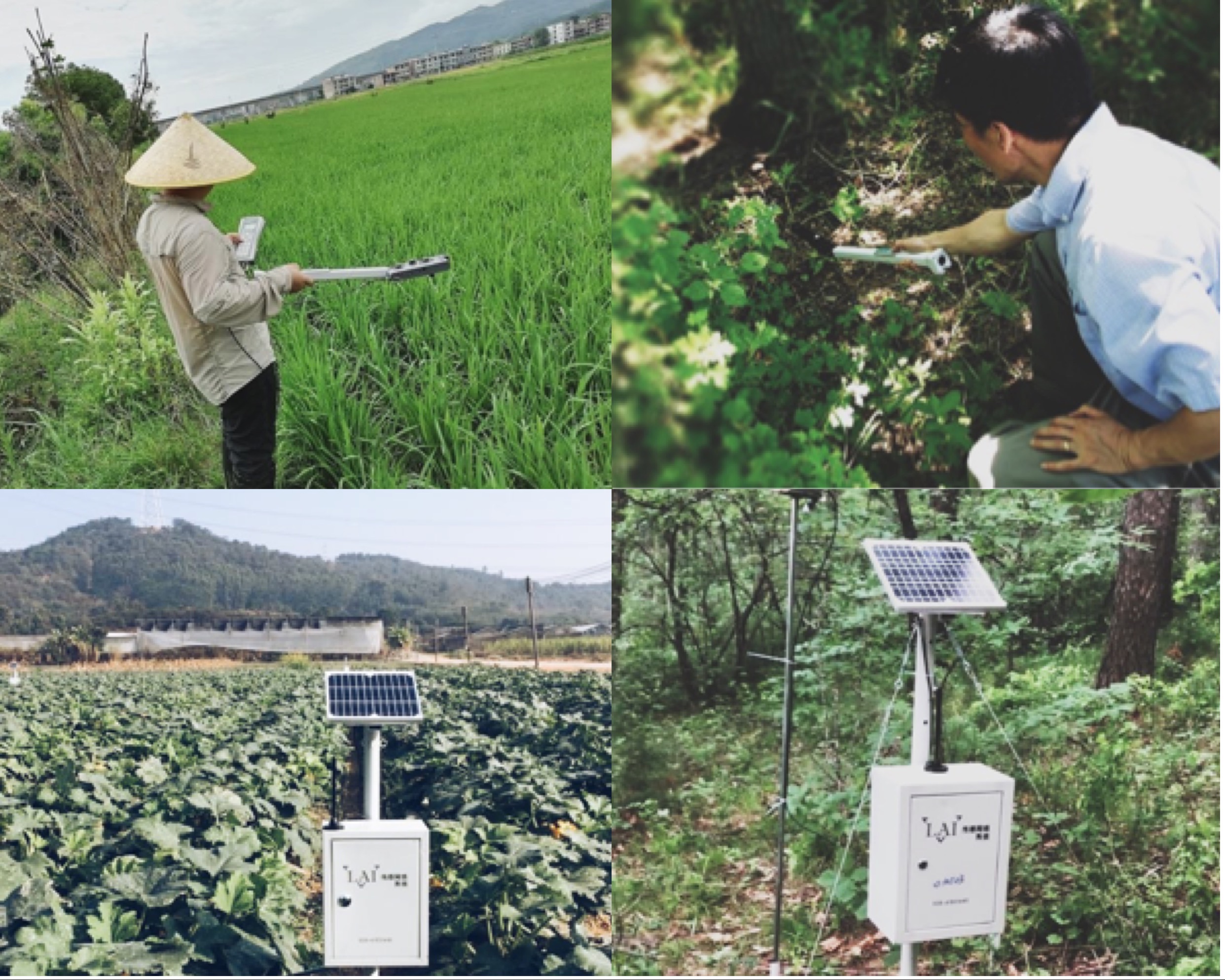
The canopy analyzer, which is developed by Beijing Ecotek Technology Co., Ltd., and the LAI wireless transmission system, by Chengdu NengTong Technology Co., Ltd, have been deployed across the country to build a vegetation measurement data acquisition network which integrates manual and automatic instruments, and features coexistence of scattered and fixed-point measurement modes, as well as a combination of selected spots and the entire areas.
The canopy analyzer is deployed in 13 typical vegetation stations across China, and each site is set with 20 48m × 48m fixed sample areas. The nationwide joint measurement is carried out to obtain huge space and ground - based observation data during the vegetation growth period.
The LAI wireless sensor system is deployed in 14 typical vegetation stations across China, and each station is installed with 10 data acquisition nodes in accordance with the field sampling rules. The system is capable of synchronously acquiring continuous ground observation data, with 5-minute sampling frequency, and over a long term.
The data obtained from the two instruments, by drawing on the advantages of each other in terms of time and space, can provide full coverage to support the validation of satellite vegetation products.
As of September 2020, the network has obtained more than 14 million valid original data, covering such indexes as LAI, canopy temperature, clumping index, vegetation leaf inclination, and other vegetation information.
News & Events