-
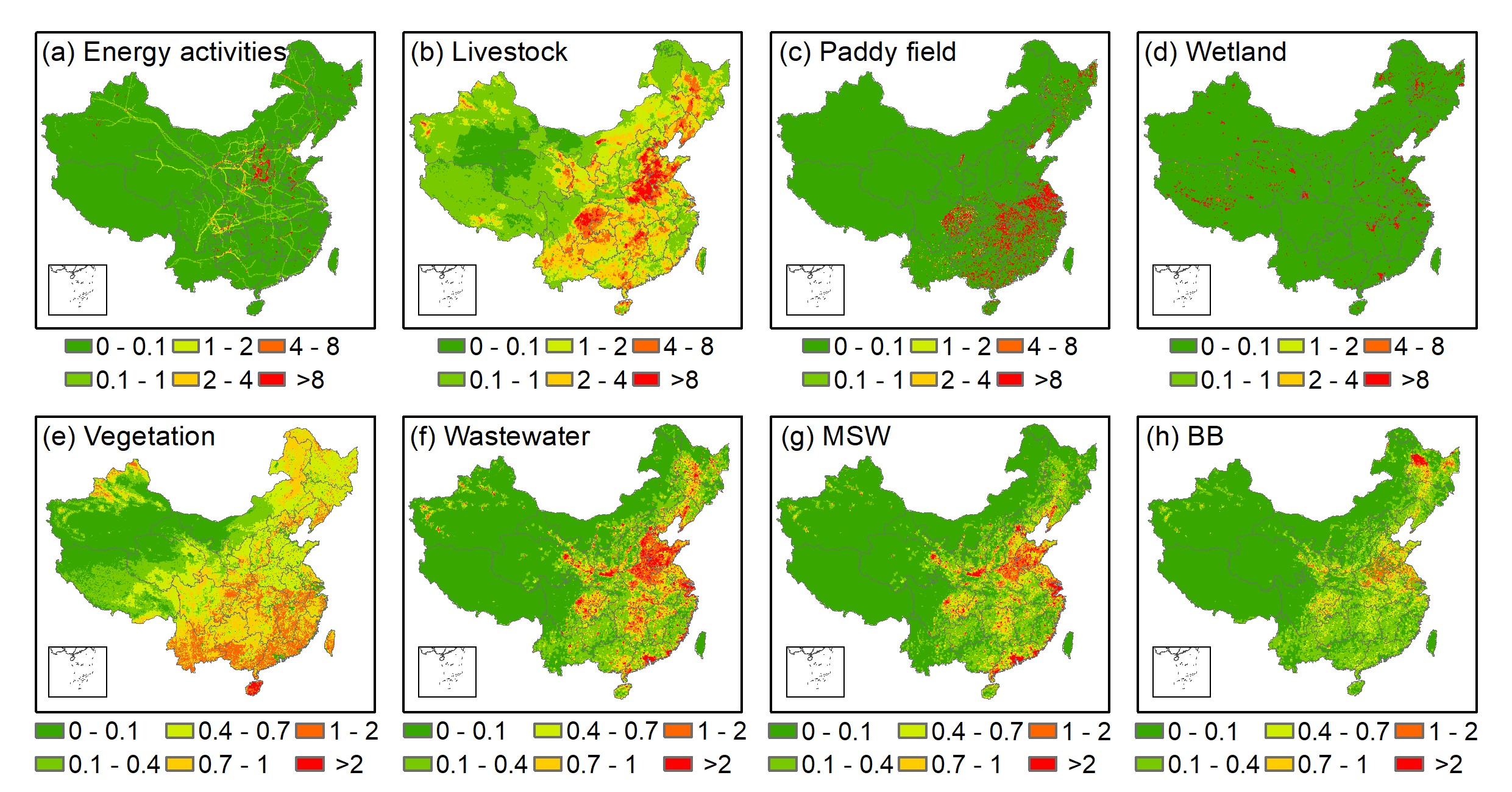
Human Activity Proven Main Factor of China's Methane Emissions: Study
BEIJING, May 21 (Xinhua) -- Chinese researchers have developed a comprehensive inventory of methane emissions and found that human activity is the largest contributor.
May 22, 2021
-
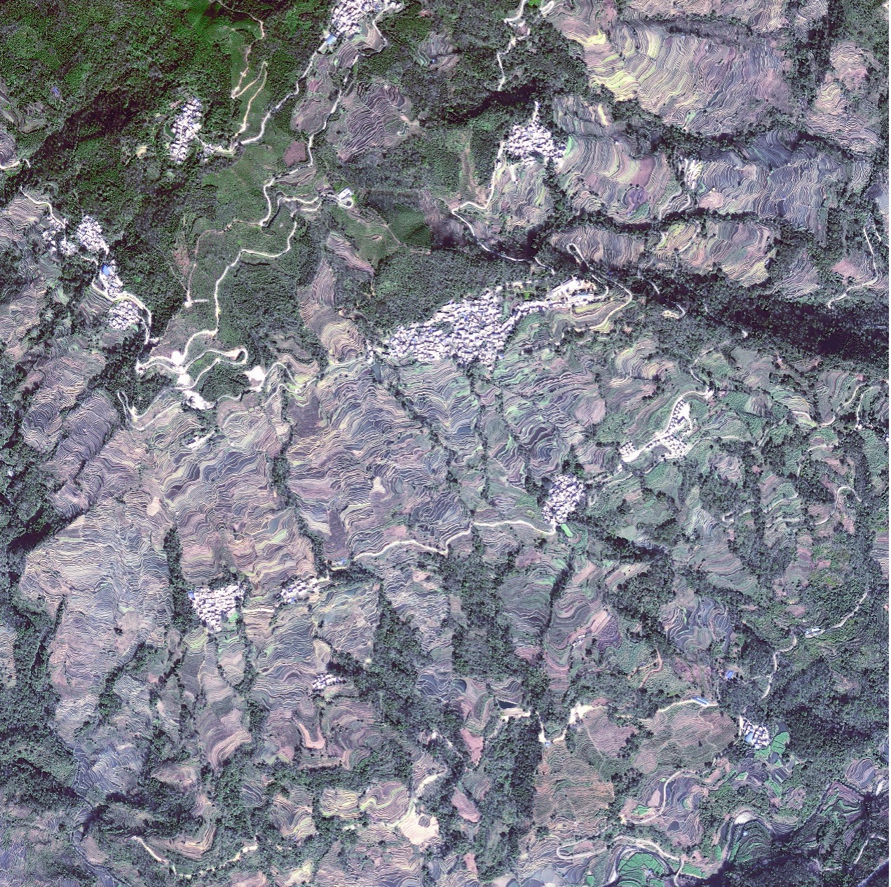
Virtual Tour of Sceneries across China from Space
On the 11th year of China Tourism Day, scientists from the International Centre on Space Technologies for Natural and Cultural Heritage (HIST) under the auspices of UNESCO, and the Aerospace Information Research Institute (AIR) present images of some well-known sceneries of China captured by GF satellites. Let's take a virtual tour of China guided by the unique "eyes" from space.
May 19, 2021
-
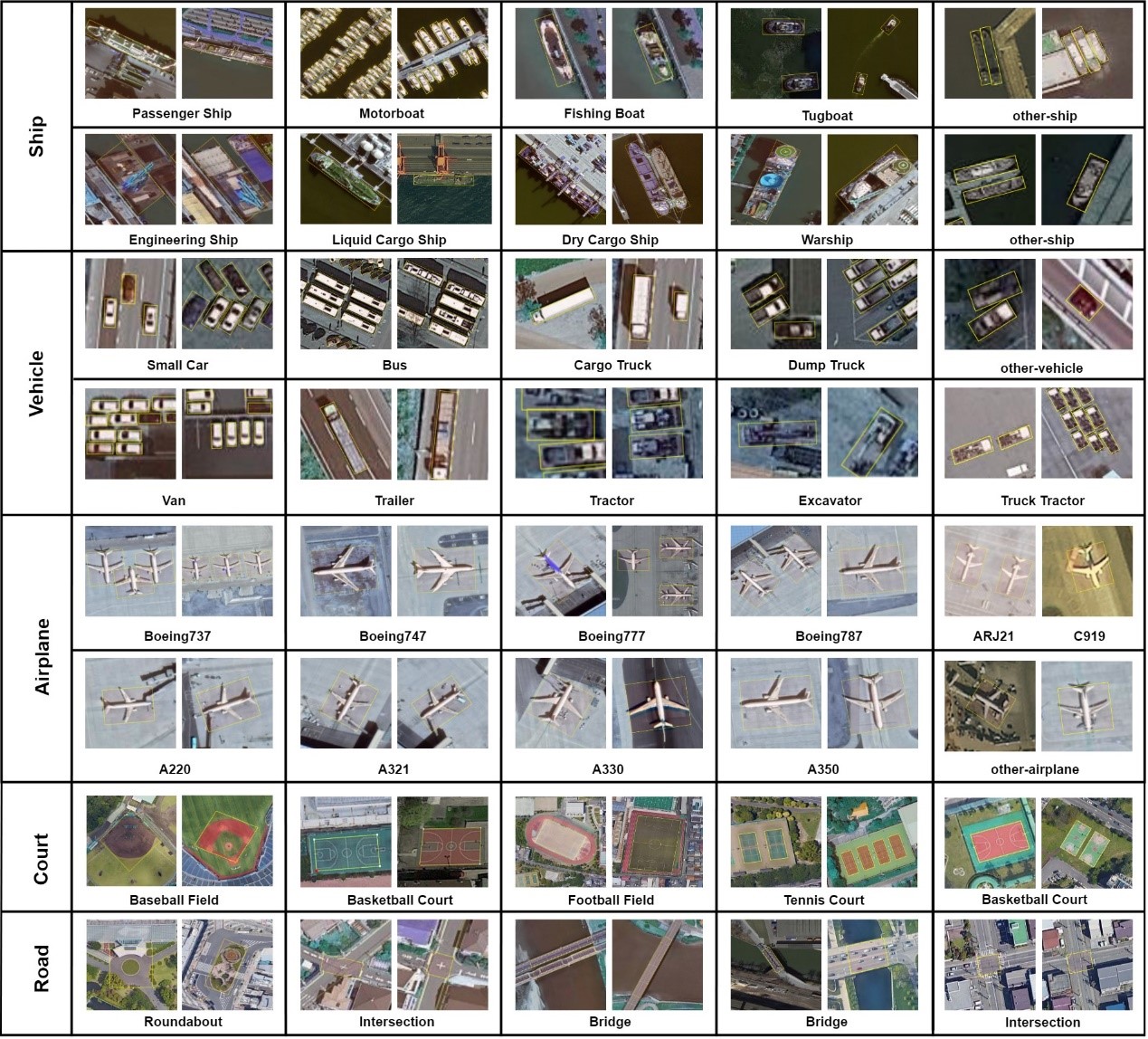
China Releases Benchmark Dataset for Millions of Fine-grained Object Recognition in High-Resolution Remote Sensing Imagery
A high-resolution satellite imaging dataset containing millions of fine-grained objects (FAIR1M) has been launched to promote the development of remote sensing image interpretation technology, according to the Aerospace Information Research Institute (AIR), Chinese Academy of Sciences.
May 10, 2021

-
Rivers of China from Space
China designated April 24 as Space Day in 2016 to mark the anniversary of the country's first satellite launch, Dongfanghong-1 in 1970. Since then, China has achieved multiple milestones in space.
Apr 25, 2021

-
Satellite Images Show Wetlands of China
The World Earth Day, which falls on April 22 every year, is a global campaign specially set up for world environmental protection, aiming at raising people's awareness of existing environmental problems, mobilizing people to participate in environmental protection campaigns, and improving the overall environment of the Earth through green and low-carbon life.
Apr 22, 2021
-
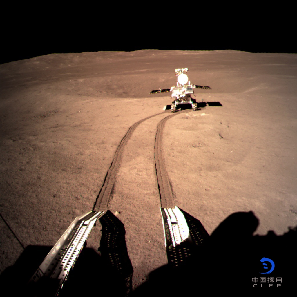
China's Lunar Rover Travels 682.77 Meters on Far Side of Moon
BEIJING, March 22 (Xinhua) -- The lander and the rover of the Chang'e-4 probe have been switched to dormant mode for the lunar night after working stably for a 28th lunar day, according to the Lunar Exploration and Space Program Center of the China National Space Administration.
Mar 23, 2021

-
70% of Large Lakes in China Clearer since 2000: Study
A recent study found that the water of 70 percent of the 165 large lakes in China has become clearer in the past 20 years. The study, conducted by scientists at the Chinese Academy of Sciences (CAS), observed and recorded the color and transparency variations of the worlds' 1,049 large lakes and reservoirs with an area of 25 square kilometers or above between 2000 and 2018.
Mar 15, 2021

-
One-Third of Global Lakes Shift Color since 2000: Study
BEIJING, Feb. 9 (Xinhua) -- More than one-third of hundreds of 25-square-km and above lakes in the world have become clearer over the past 20 years, according to a new study published online in the journal Scientific Data.
Feb 10, 2021
-
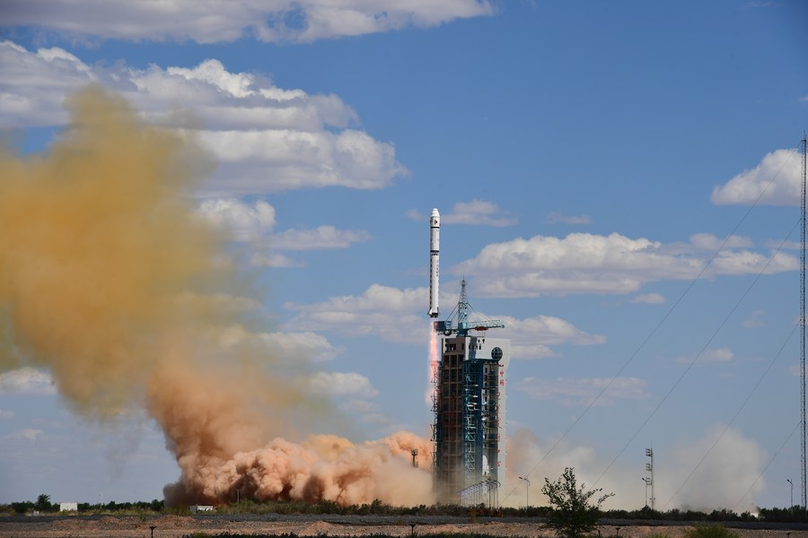
China Collects 100PB of Earth Observation Data
BEIJING, Jan. 22 (Xinhua) -- China has collected around 100PB (about 100 million GB) of Earth observation data, according to the Aerospace Information Research Institute (AIR) under the Chinese Academy of Sciences (CAS).
Jan 22, 2021
-
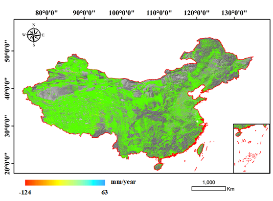
AIR Releases Nationwide InSAR Deformation Map
A research team led by Prof. WANG Chao from the Aerospace Information Research Institute (AIR) of the Chinese Academy of Sciences (CAS), and their cooperators released a nationwide deformation map relying on China's first supercomputing based Interferometric Synthetic Aperture Radar (InSAR) processing system.
Jan 05, 2021

-
New Data-sharing Platform Launched for Near-space Research
BEIJING, Dec. 10 (Xinhua) -- China has launched a platform for sharing near-space science data to facilitate research, according to the Chinese Academy of Sciences (CAS).
Dec 11, 2020

-
GUO Huadong Expounds on Role of Big Earth Data at Internet Development Forum
A main forum themed "Science, Technology and Innovation for Development" was jointly organized by the Chinese Academy of Sciences (CAS) and China Association for Science and Technology (CAST) to discuss the role of innovation in the development. Prof. GUO Huadong, a CAS Member, addressed the opening ceremony, saying that CAS is leading an effort to build an International Research Center of Big Data for Sustainable Development Goals to facilitate the implementation of the 2030 UN Agenda for Sustainable Development.
Dec 01, 2020
-
Chinese Institute, Science Magazine Jointly Launch Remote Sensing Journal
BEIJING, Nov. 2 (Xinhua) -- An institute under the Chinese Academy of Sciences (CAS) has partnered with the renowned Science Magazine to launch an English-language journal offering research in the field of remote sensing, which will publish its first issue online in early 2021.
Nov 02, 2020
-
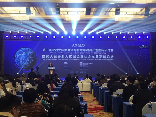
15 Countries Join the Asia-Oceania Group on Earth Observations
NANJING, Oct. 31 (Xinhua) -- Fifteen countries in the Asia-Oceania region and several international organizations have participated in the Asia-Oceania Group on Earth Observations (AOGEO), a Chinese scientist said.
Nov 01, 2020

-
High-resolution Global Soil Respiration Dataset Generated for Carbon Emission Study
BEIJING, Oct. 22 (Xinhua) -- Researchers have developed a dataset for annual global soil respiration at a spatial resolution of 1 square km for the period between 2000 and 2014.
Oct 23, 2020


News & Events