Satellite Data from China Helps Tonga with Disaster Response
Feb 02, 2022
On January 25, the “Volunteer Rapid Disaster Monitoring and Mapping (Hunga Tonga-Hunga Ha'apai Volcanic Eruption)”, which was jointly developed by the Aerospace Information Research Institute (AIR) under the Chinese Academy of Sciences (CAS) and New Zealand Tonkin + Taylor, was recommended to Tonga government through the academic channel. The platform has been handed over the Tonga government departments for use on the same day, according to Tongan Prime Minister Siaosi Sovaleni in a thank-you email.
The platform has provided 12 post-disaster Chinese high-resolution satellites data, including HISEA-1 SAR images, Jilin1 and BJ3A optical images, and Zhuhai-1 hyperspectral images provided by ChinaGEOSS, combining with information such as population and settlement distribution affected by Tonga Volcanic Eruption provided by National Earth Observation Data Center (NODA), distribution data of affected villages provided by Global Disaster Alert and Coordination System(GDACS), affected population data provided by United Nations Satellite Centre (UNOSAT), and disaster reduction data from the European Space Agency (ESA) to analyze the disaster losses and therefore to facilitate Tonga relief efforts.
The platform is based on the “Volunteered Rapid Disaster Monitoring and Mapping program” (VoRDM), marking its first application in South Pacific islands. VoRDM was initiated by AIR in October 2021, with a goal to reduce disaster losses and improve disaster management capabilities for developing countries through global cooperation network based on the philosophy of “open science”. Its co-sponsors currently include the National Earth Observation Data Center (NODA), China GEO Secretariat (ChinaGEO), the New Zealand GEO, CODATA, Japan’s Institute of Physical and Chemical Research (RIKEN), and the International Knowledge Centre for Engineering Sciences and Technology under the Auspices of UNESCO.
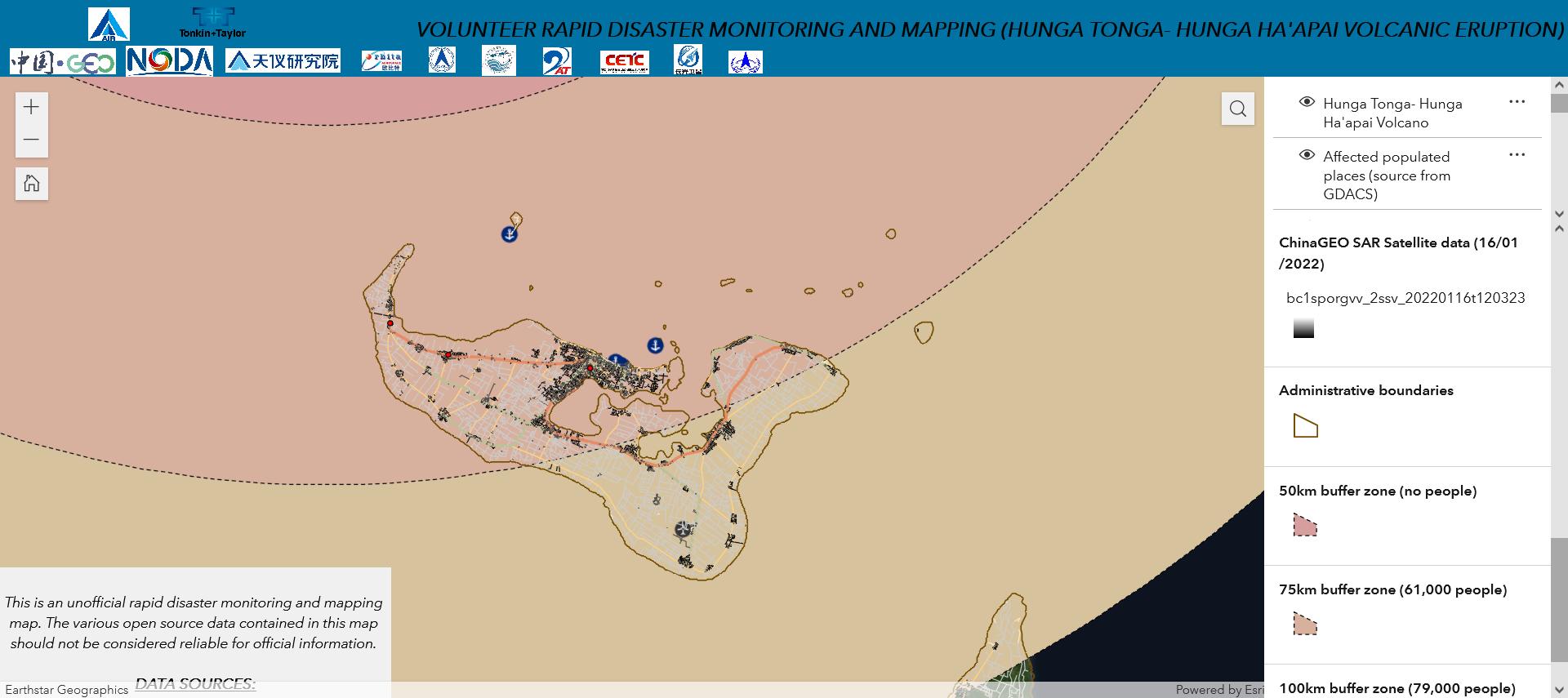
Fig1. Volunteer Rapid Disaster Monitoring and Mapping (Hunga Tonga-Hunga Ha'apai Volcanic Eruption).
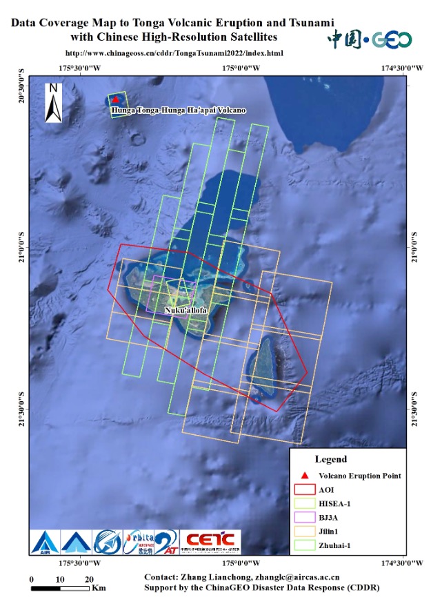
Fig2. Data Coverage Map to Tonga Volcanic Eruption and Tsunami with Chinese High-resolution Satellites. (Image by Aerospace Information Research Institute)
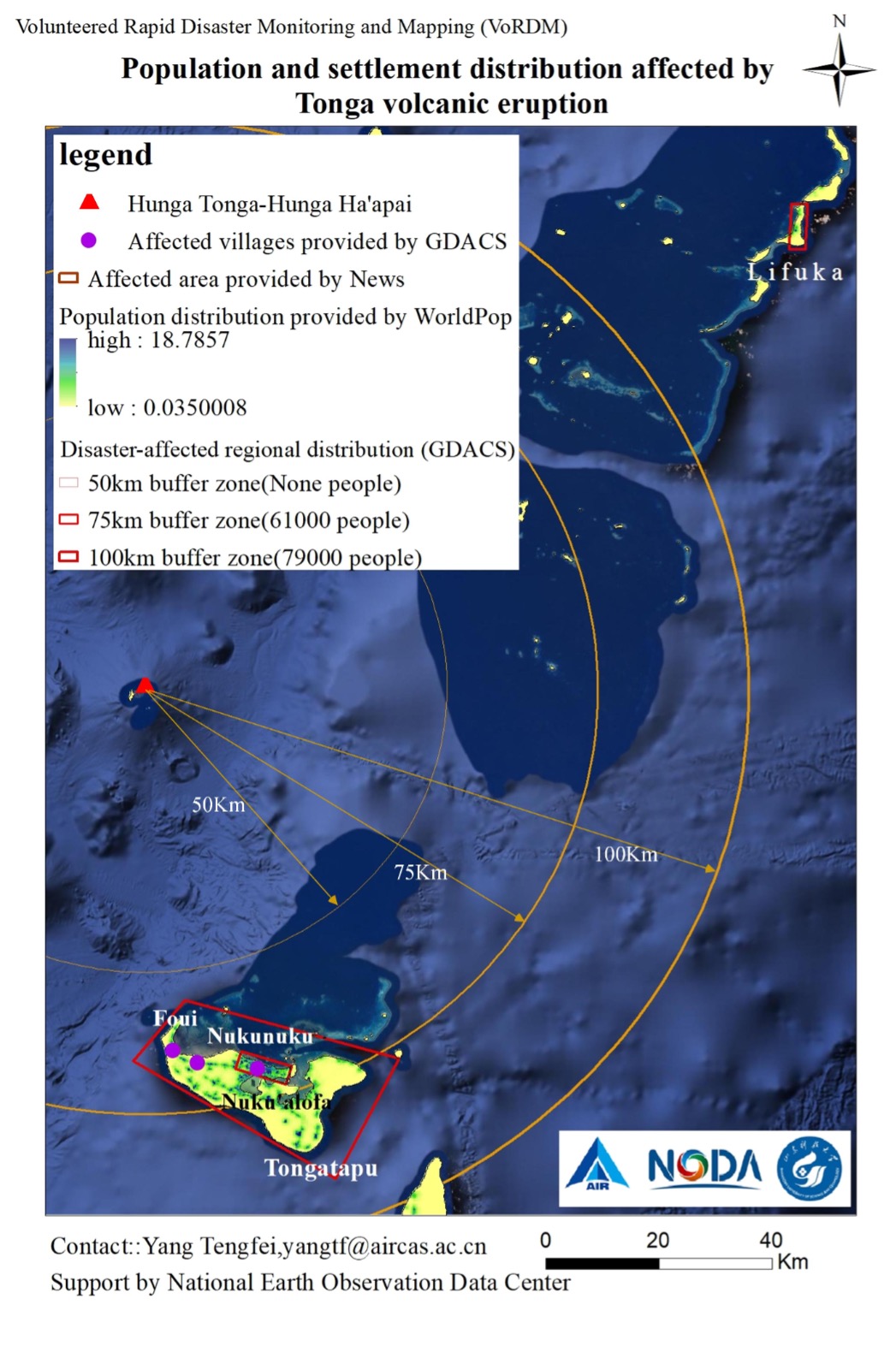
Fig3. Distribution Map of Population and Settlement affected by Tonga Volcanic Eruption. (Image by Aerospace Information Research Institute)
News & Events